Harvey Mountain State Forest
Download a High Resolution JPEG Image of the Harvey Mountain State Forest or an Adobe Acrobat Printable PDF of the Harvey Mountain State Forest.


Bookmark my free Interactive GPS Map for your phone:
https://andyarthur.org/ny
... shows your location as a blue dot in relationship to campsites, trails, state land. This online map requires cell service, won't work in remote country, so also bring a paper map.
Free Download of New & Historical USGS 1:24k Topograpic Maps
Interactive maps with backcountry and roadside camping: New York, Pennsylvania, West Virginia & Vermont. List of NYS DEC Lean-Tos and Firetowers.
Google Spreadsheet with Roadside, Primitive and Pay Campsites
More about Harvey Mountain State Forest...
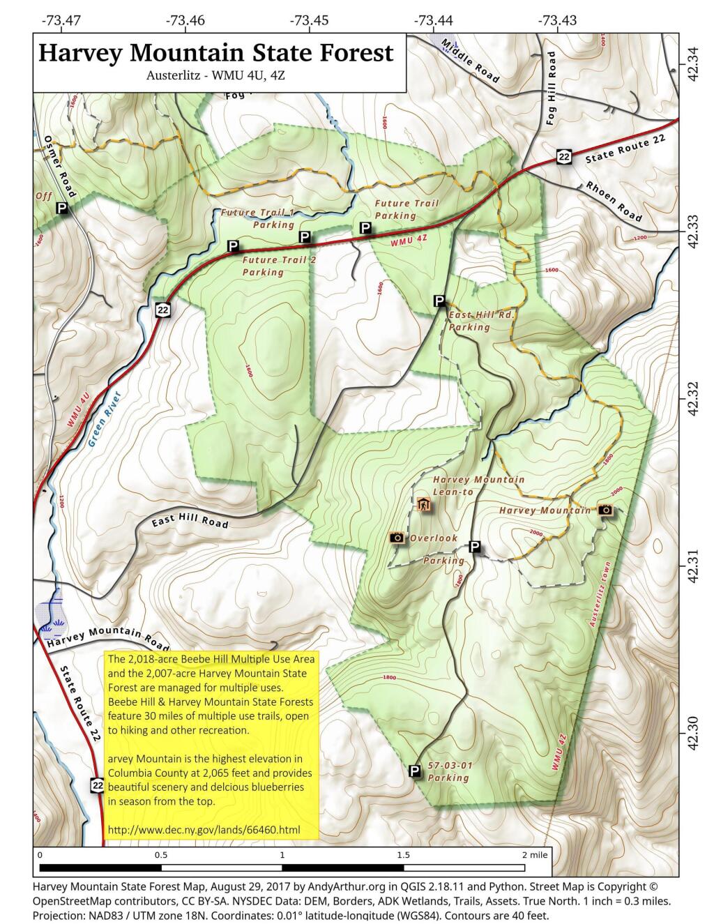
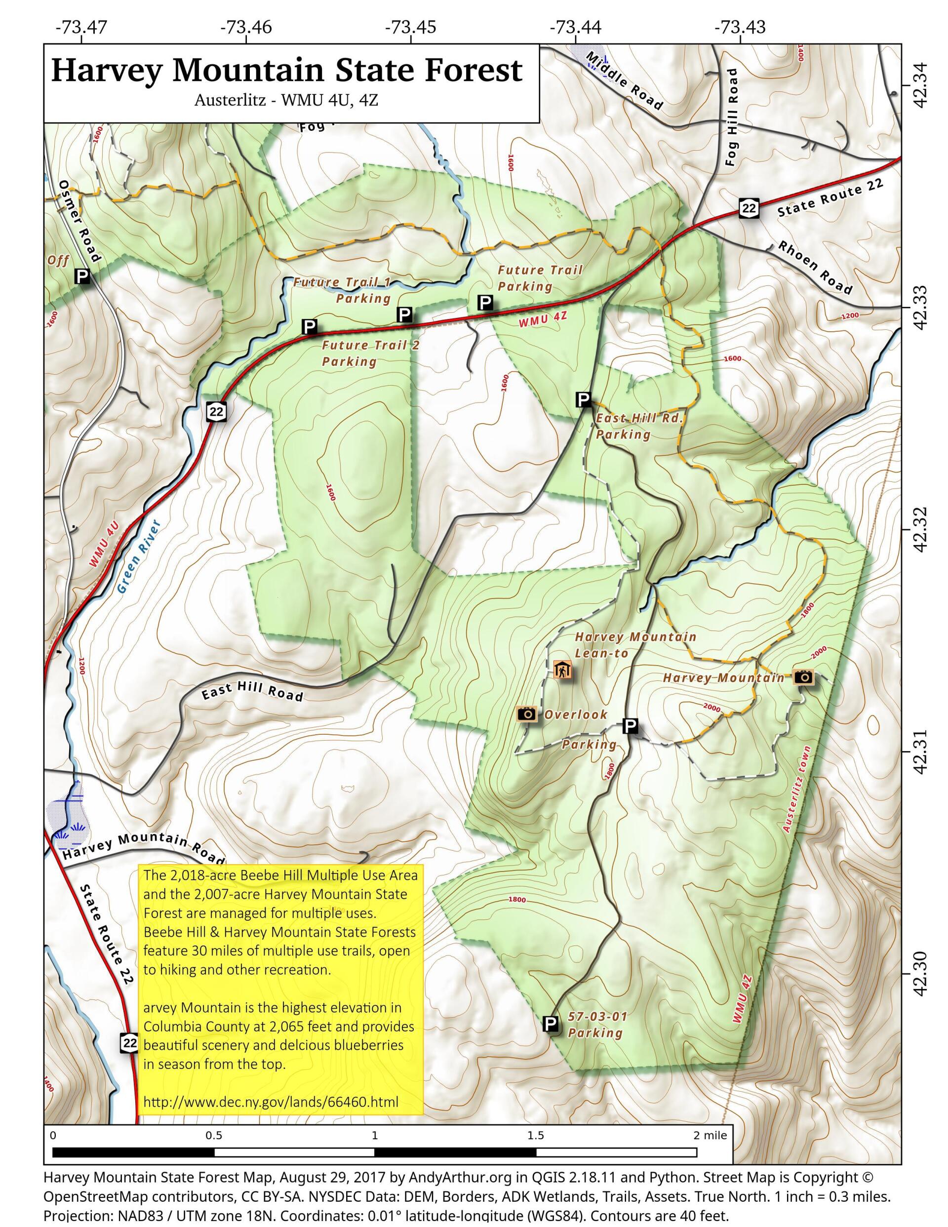
Harvey Mountain State Forest are managed for multiple uses, including timber production, watershed protection, wildlife habitat and recreation. Recreational opportunities include hiking, biking, picnicking, horseback riding (except on foot trails and snowmobile/ski trails when snow covered), camping, snowmobiling, cross-country skiing, hunting, fishing, trapping, wildlife observation and photography.
Harvey Mountain State Forest also has a lean-to along the trail, as well as a large, unique blueberry patch at the summit of the mountain.
http://www.dec.ny.gov/lands/66460.html


