Whetstone Gulf State Park
Download a High Resolution JPEG Image of the Whetstone Gulf State Park or an Adobe Acrobat Printable PDF of the Whetstone Gulf State Park.


Bookmark my free Interactive GPS Map for your phone:
https://andyarthur.org/ny
... shows your location as a blue dot in relationship to campsites, trails, state land. This online map requires cell service, won't work in remote country, so also bring a paper map.
Free Download of New & Historical USGS 1:24k Topograpic Maps
Interactive maps with backcountry and roadside camping: New York, Pennsylvania, West Virginia & Vermont. List of NYS DEC Lean-Tos and Firetowers.
Google Spreadsheet with Roadside, Primitive and Pay Campsites
More about Whetstone Gulf State Park...
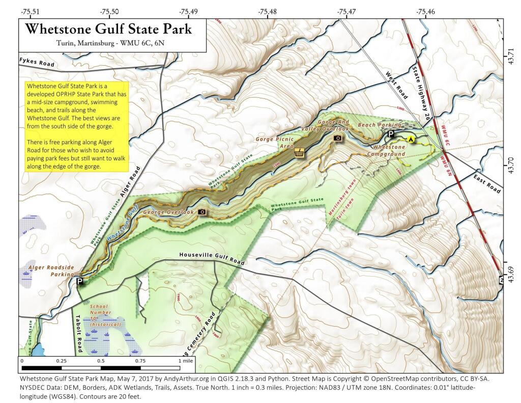
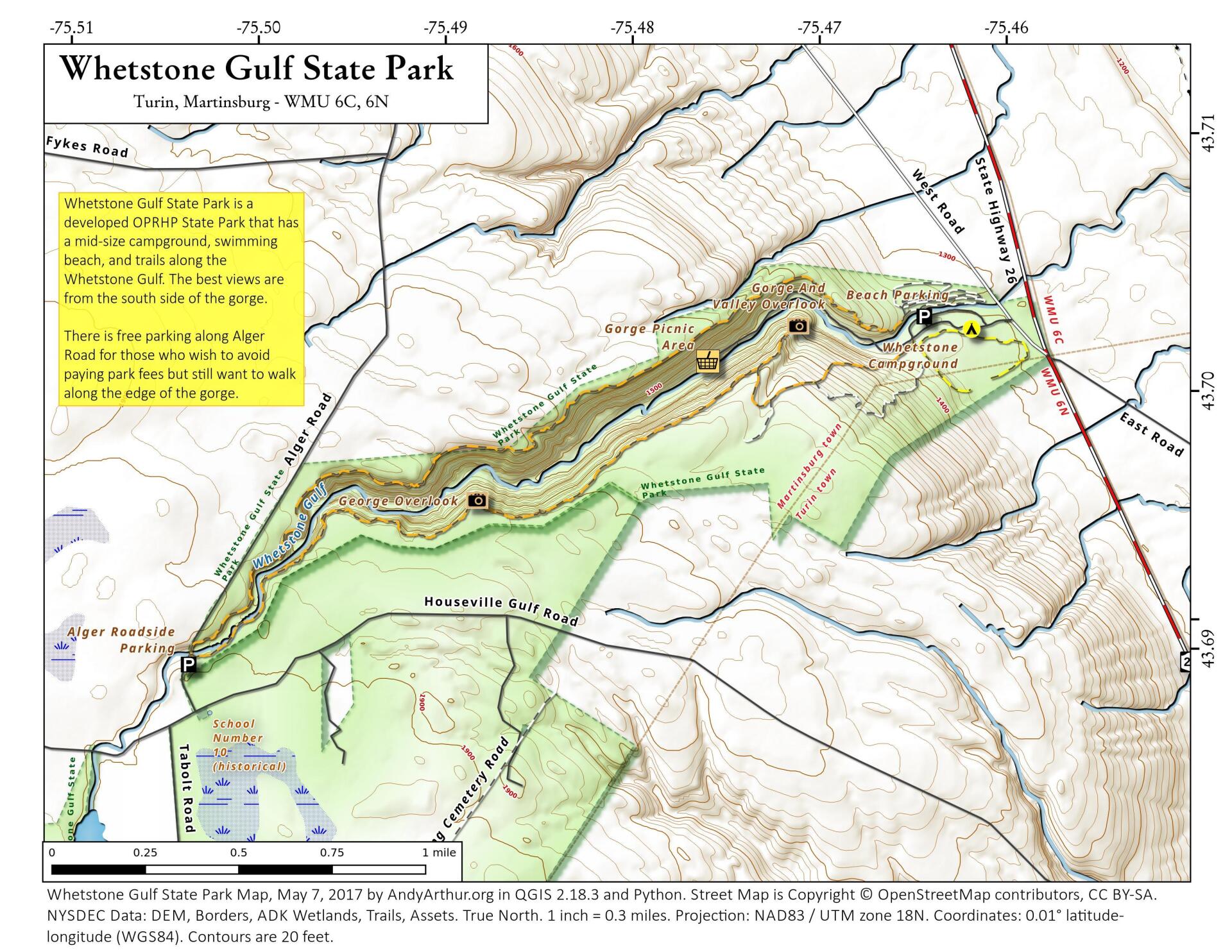
Whetstone Gulf State Park is built in and around a three-mile-long gorge cut into the eastern edge of the Tug Hill Plateau. The gorge is one of the most spectacular scenic vistas east of the Rocky Mountains. The park has 56 wooded campsites- some of which are electric, a scenic picnic area along Whetstone Creek, a man-made swimming area and trails for hiking and cross-country skiing, one of which circles the gorge. Above the gorge is Whetstone Reservoir, stocked with tiger muskie and large-mouth bass for fishermen, and popular for canoeing.
http://nysparks.com/parks/92/details.aspx
Download the PDF Map Pack with All Maps from Whetstone Gulf State Park.


