Average Yearly Temperature
Download a High Resolution JPEG Image of the Average Yearly Temperature or an Adobe Acrobat Printable PDF of the Average Yearly Temperature.
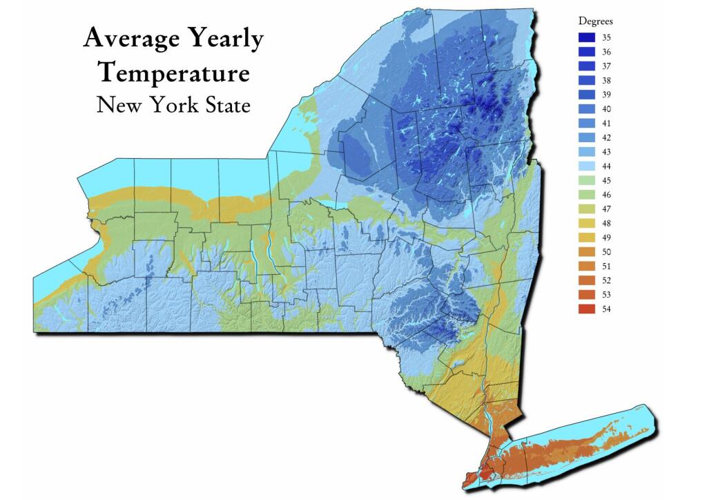
About Map: Average Yearly Temperature ....
See also the interactive map: http://andyarthur.org/google-maps-average-yearly-temperature-in-new-york.html
Data Source: This coverage contains data representing areas (polygons) of Average Temperature for the period 1971-2000. From the PRISM Group at Oregon State University. https://datagateway.nrcs.usda.gov/GDGOrder.aspx?order=QuickState


Bookmark my free Interactive GPS Map for your phone:
https://andyarthur.org/ny
... shows your location as a blue dot in relationship to campsites, trails, state land. This online map requires cell service, won't work in remote country, so also bring a paper map.
Free Download of New & Historical USGS 1:24k Topograpic Maps
Interactive maps with backcountry and roadside camping: New York, Pennsylvania, West Virginia & Vermont. List of NYS DEC Lean-Tos and Firetowers.
Google Spreadsheet with Roadside, Primitive and Pay Campsites
More about Winter...

