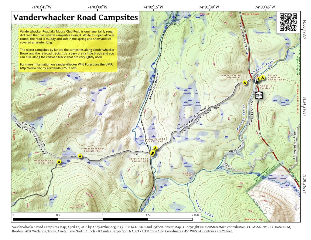
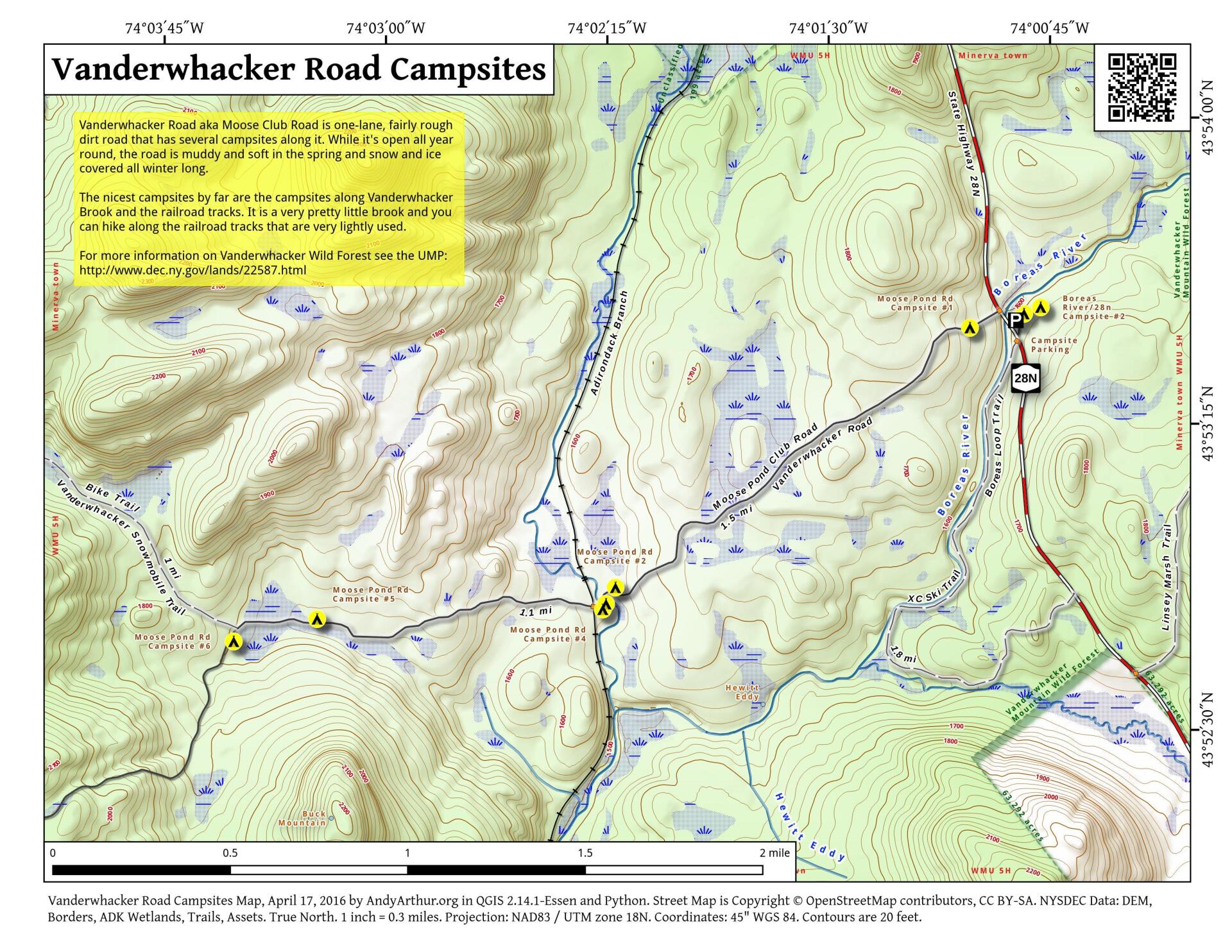
Vanderwhacker Road Campsites
Download a High Resolution JPEG Image of the Vanderwhacker Road Campsites or an Adobe Acrobat Printable PDF of the Vanderwhacker Road Campsites.


Bookmark my free Interactive GPS Map for your phone:
https://andyarthur.org/ny
... shows your location as a blue dot in relationship to campsites, trails, state land. This online map requires cell service, won't work in remote country, so also bring a paper map.
Free Download of New & Historical USGS 1:24k Topograpic Maps
Interactive maps with backcountry and roadside camping: New York, Pennsylvania, West Virginia & Vermont. List of NYS DEC Lean-Tos and Firetowers.
Google Spreadsheet with Roadside, Primitive and Pay Campsites
More about Vanderwhacker Mountain Wild Forest...
Vanderwhacker Mountain Wild Forest is a 91,854-acre public preserve in New York’s Adirondack Park. The diverse terrain features quiet lakes, vast wetlands, and rugged peaks. The highlight is the 3,386-foot Vanderwhacker Mountain, which features a restored fire tower offering panoramic views of the High Peaks. Visitors enjoy primitive camping, backcountry hiking, paddling, and snowmobiling. It provides a peaceful, less-crowded wilderness experience for outdoor enthusiasts seeking rugged Adirondack beauty.
Download the PDF Map Pack with All Maps from Vanderwhacker Mountain Wild Forest.


No Comments
Hey Andy,
My husband and I are planning a trip to hike Vanderwhacker Mountain this spring/early summer. I’ve enjoyed looking at your maps, and I’m wondering, are the campsites on the Vanderwhacker Road all reachable by car? We have a softshell RTT and would like to use it. If you have other suggestions for that area, I’m open to them.
Thank you so much!
Yes, but the road is very soft, especially west of Vanderwhacker Brook in the spring and you might get stuck if you go in the spring or after rain. East of the Vanderwhacker Brook is usually harder. There might be snow and ice up there though for a few more weeks, and right after the snow and ice melts the road will likely be very soft. I don’t think the road is baracaded in the winter.