ATV Use on Local Roads 🖼️
Download a JPEG Image of the ATV Use on Local Roads.
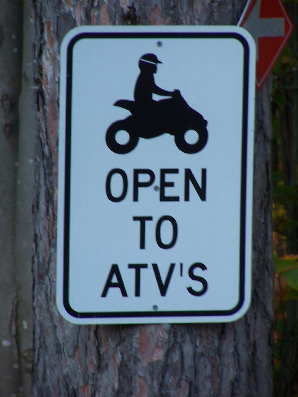
ATV Use on Local Roads ...
These signs at on almost every County and Local road on the Tug Hill Plateau (Oswego, Lewis Counties). I've seen them in downtown Altmar/Sandy Creek/Adams. Many roads have posted ATV speed limits -- 25 MPH on rural stretches, 15 MPH in town. Don't tell anybody in Albany-land, as they like to believe ATV use on roads is only for minimal crossing of roads to other trails. Then again, all kinds to stuff happens on Tug Hill Plateau, that the folks back in Albany really don't want to know about.
Taken on Sunday October 3, 2010 at Salmon River Reservoir.

More about Salmon River Reservoir...
The Salmon River arises in north central New York State on the Tug Hill Plateau to the east of Lake Ontario. It flows 44 miles (71 km) westward off the plateau and there is a hydroelectric dam near Little America to create the Salmon River Reservoir. Both the Salmon River and Salmon River Reservoir are heavily visited destinations for fishermen during peak season. Below the dam it continues westward for about a mile eventually creating Salmon River Falls which is a large 100-foot (30 m) drop as the river continues its westward progress towards yet another dam and the Lower Salmon River Reservoir. It continues westward through the village of Altmar through Pulaski to Lake Ontario. The inlet is referred to as Port Ontario, though it is no longer an active commercial port. The watershed drains 285 square miles (740 km2).[1]
The river is noted for its recreational salmon fishery today. The fishery is possible due to the efforts of the Salmon River Fish Hatchery that is located north of Altmar on a tributary to the Salmon River called Beaver Dam Brook. The hatchery stocks over 3.5 million trout and salmon each year in the surrounding areas.[2] In early history this was Atlantic salmon, but now these have been mostly replaced by stocked coho, chinook, and steelhead which make spawning runs upriver from Lake Ontario in autumn.
The river has become a popular location for kayaking and river rafting during parts of the year when the dam is released, with several companies making excursions to the river.
http://en.wikipedia.org/wiki/Salmon_River_%28New_York%29
http://www.dec.ny.gov/outdoor/60775.html
http://www.quietkayaking.webs.com/qknyssalmonriver.html
Download the PDF Map Pack with All Maps from Salmon River Reservoir.

")
")


