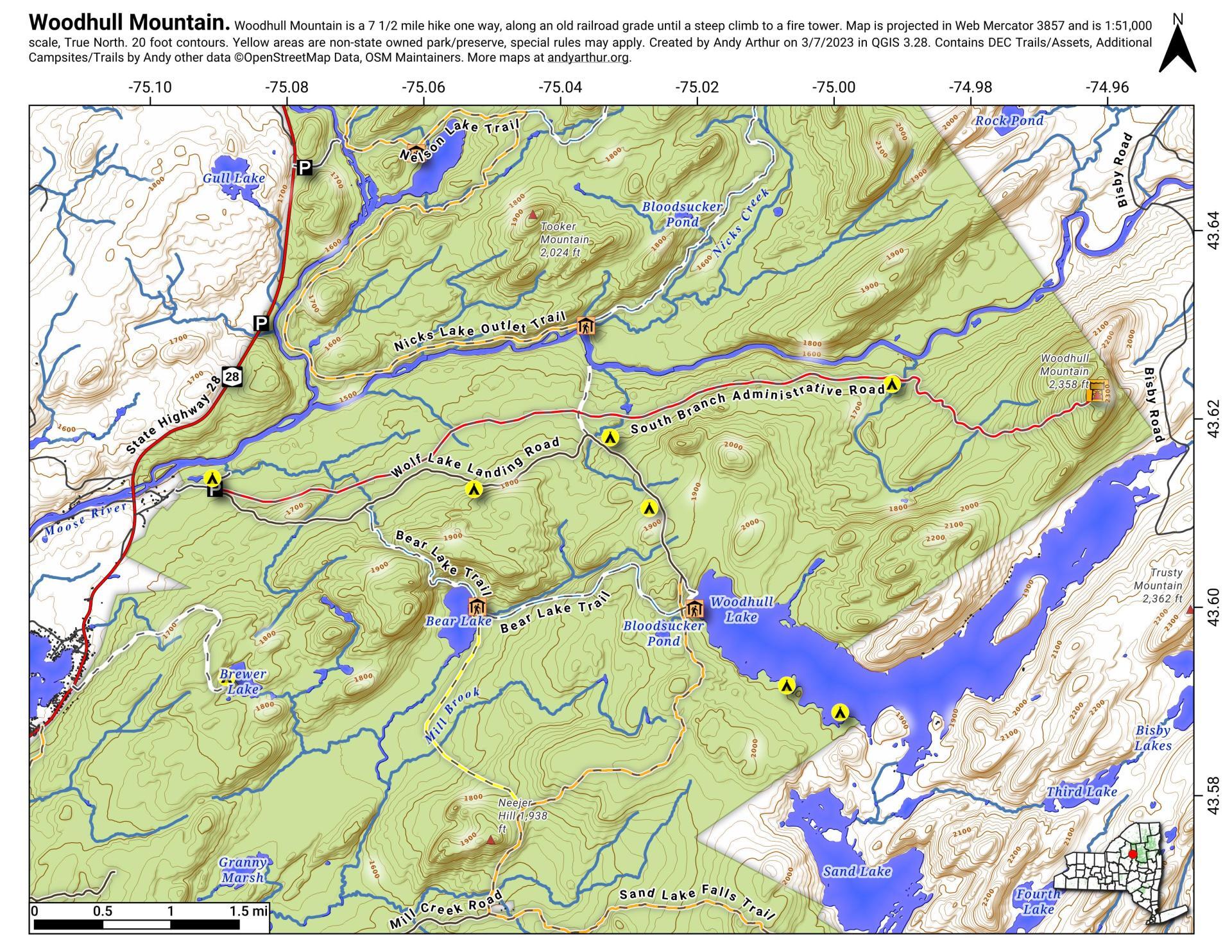
Woodhull Mountain
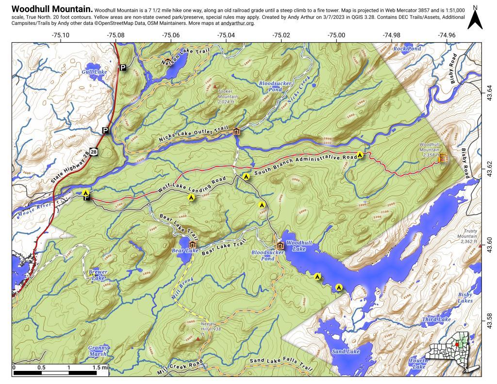
Download a High Resolution JPEG Image of the Woodhull Mountain or an Adobe Acrobat Printable PDF of the Woodhull Mountain.


Bookmark my free Interactive GPS Map for your phone:
https://andyarthur.org/ny
... shows your location as a blue dot in relationship to campsites, trails, state land. This online map requires cell service, won't work in remote country, so also bring a paper map.
Free Download of New & Historical USGS 1:24k Topograpic Maps
Interactive maps with backcountry and roadside camping: New York, Pennsylvania, West Virginia & Vermont. List of NYS DEC Lean-Tos and Firetowers.
Google Spreadsheet with Roadside, Primitive and Pay Campsites
More about Woodhull Lake Reservior...
1,118 acres in McKeaver NY, before you cross the Moose River Bridge on NY 28, about a 2 mile drive back from NY 28. The lake depth varies from about 20 feet in shallower portions to as much as a 90 feet on the eastern portions of lake. Home to Lake Trout, Brook Trout, Splake, White Sucker, Yellow Perch, Brown Bull, and Golden Shiner.
http://www.dec.ny.gov/docs/fish_marine_pdf/woodlkmap.pdf
Download the PDF Map Pack with All Maps from Woodhull Lake Reservior.


