Dunning Pond Trail
Download a High Resolution JPEG Image of the Dunning Pond Trail or an Adobe Acrobat Printable PDF of the Dunning Pond Trail.
About Map: Dunning Pond Trail ....
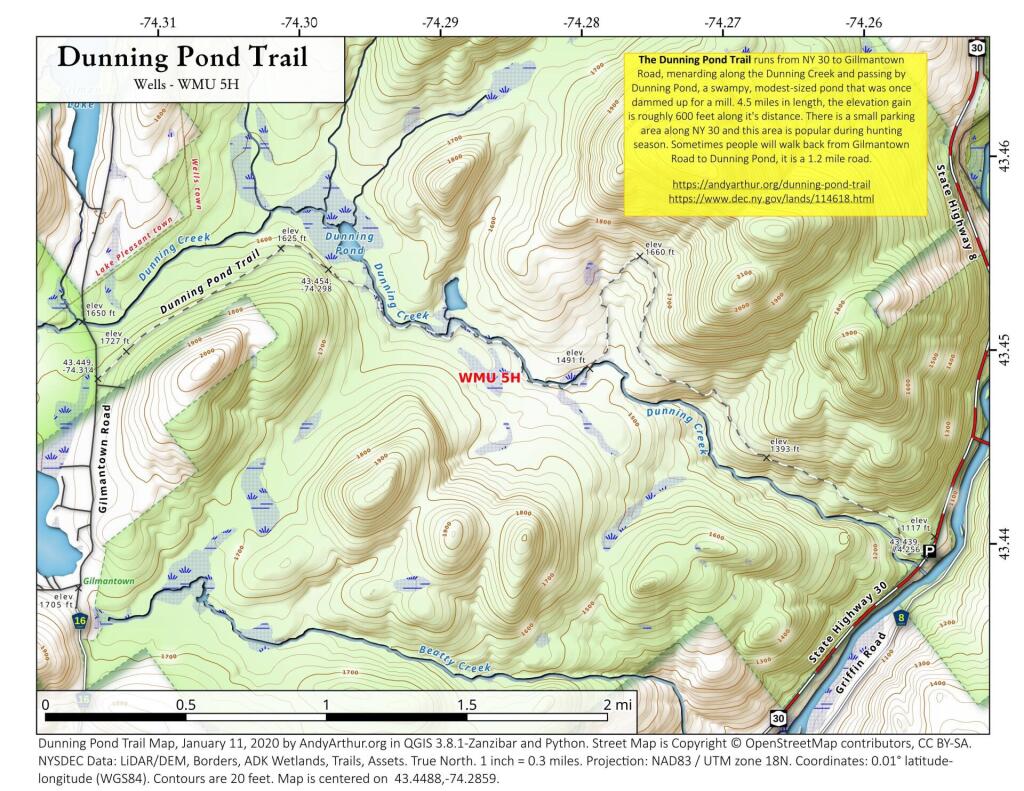
The Dunning Pond Trail runs from NY 30 to Gillmantown Road, mendaring along the Dunning Creek and passing by Dunning Pond, a swampy, modest-sized pond that was once dammed up for a mill. 4.5 miles in length, the elevation gain is roughly 600 feet along it's distance. There is a small parking area along NY 30 and this area is popular during hunting season. Sometimes people will walk back from Gilmantown Road to Dunning Pond, it is a 1.2 mile road.
https://andyarthur.org/dunning-pond-trail
https://www.dec.ny.gov/lands/114618.html


Bookmark my free Interactive GPS Map for your phone:
https://andyarthur.org/ny
... shows your location as a blue dot in relationship to campsites, trails, state land. This online map requires cell service, won't work in remote country, so also bring a paper map.
Free Download of New & Historical USGS 1:24k Topograpic Maps
Interactive maps with backcountry and roadside camping: New York, Pennsylvania, West Virginia & Vermont. List of NYS DEC Lean-Tos and Firetowers.
Google Spreadsheet with Roadside, Primitive and Pay Campsites
More about Jessup River Wild Forest...
The Jessup River Wild Forest (JRWF) area consists of 47,350 acres of State Forest Preserve lands in the towns of Arietta, Indian Lake, Lake Pleasant, and Wells in Hamilton County. The unit is bounded by Route 28 to the north and Route 30 in the southeast, as well as three wilderness areas: West Canada Lakes Wilderness to the west; Siamese Ponds Wilderness to the east, and Silver Lake Wilderness to the south. The state lands in this unit border, or are in close proximity to, the communities of Indian Lake, Piseco, Speculator and Wells. Route 30 bisects the unit and serves as the main access corridor. Many people enjoy hiking to the fire towers on Pillsbury and Snowy mountains, snowmobiling between Piseco Lake and Indian Lake, canoeing on Fall Stream, or camping on Mason Lake. Hunting, fishing, and trapping are also popular activities throughout the unit but particularly in and around Perkins Clearing, the Jessup River and the Miami River.
http://www.dec.ny.gov/lands/22599.html


