Hadley Mountain Trail
Download a High Resolution JPEG Image of the Hadley Mountain Trail or an Adobe Acrobat Printable PDF of the Hadley Mountain Trail.


Bookmark my free Interactive GPS Map for your phone:
https://andyarthur.org/ny
... shows your location as a blue dot in relationship to campsites, trails, state land. This online map requires cell service, won't work in remote country, so also bring a paper map.
Free Download of New & Historical USGS 1:24k Topograpic Maps
Interactive maps with backcountry and roadside camping: New York, Pennsylvania, West Virginia & Vermont. List of NYS DEC Lean-Tos and Firetowers.
Google Spreadsheet with Roadside, Primitive and Pay Campsites
More about Hadley Mountain...
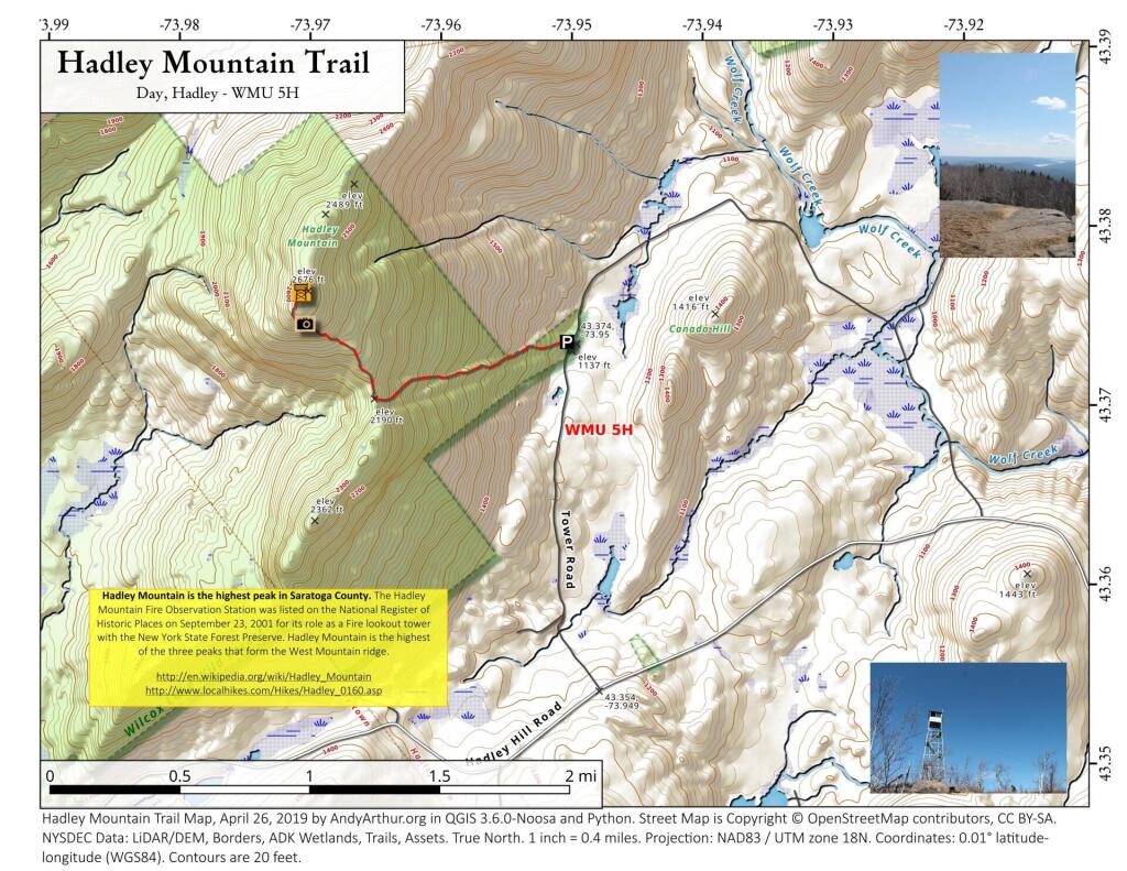
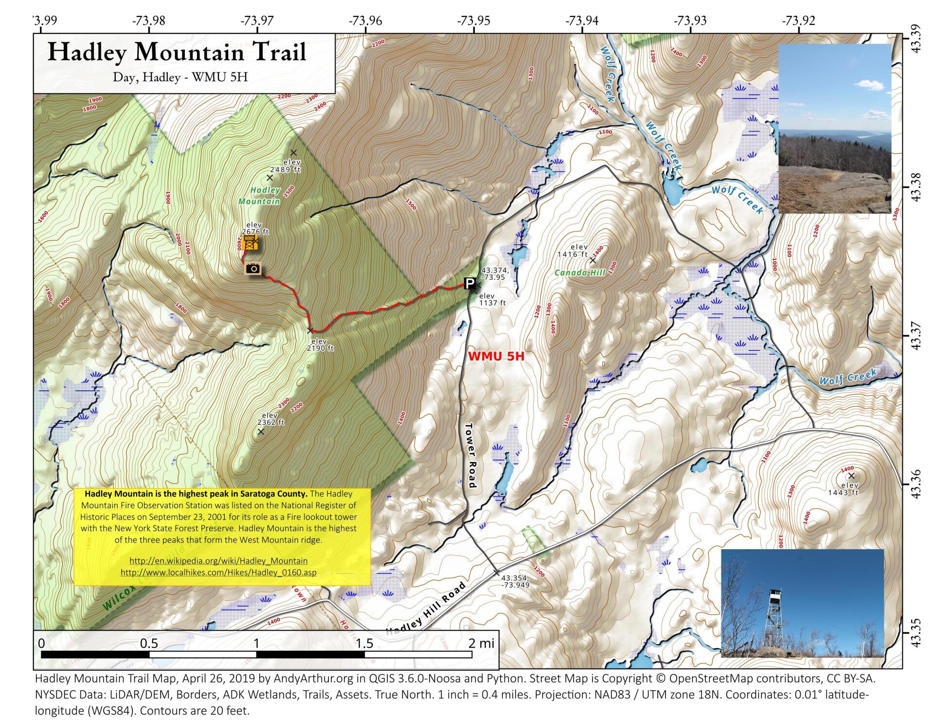
Hadley Mountain is a mountain located in the southern Adirondacks of the U.S. state of New York and is the highest peak in Saratoga County. The Hadley Mountain Fire Observation Station was listed on the National Register of Historic Places on September 23, 2001 for its role as a Fire lookout tower with the New York State Forest Preserve. Hadley Mountain is the highest of the three peaks that form the West Mountain ridge.
http://en.wikipedia.org/wiki/Hadley_Mountain
http://www.localhikes.com/Hikes/Hadley_0160.asp
Download the PDF Map Pack with All Maps from Hadley Mountain.
")


