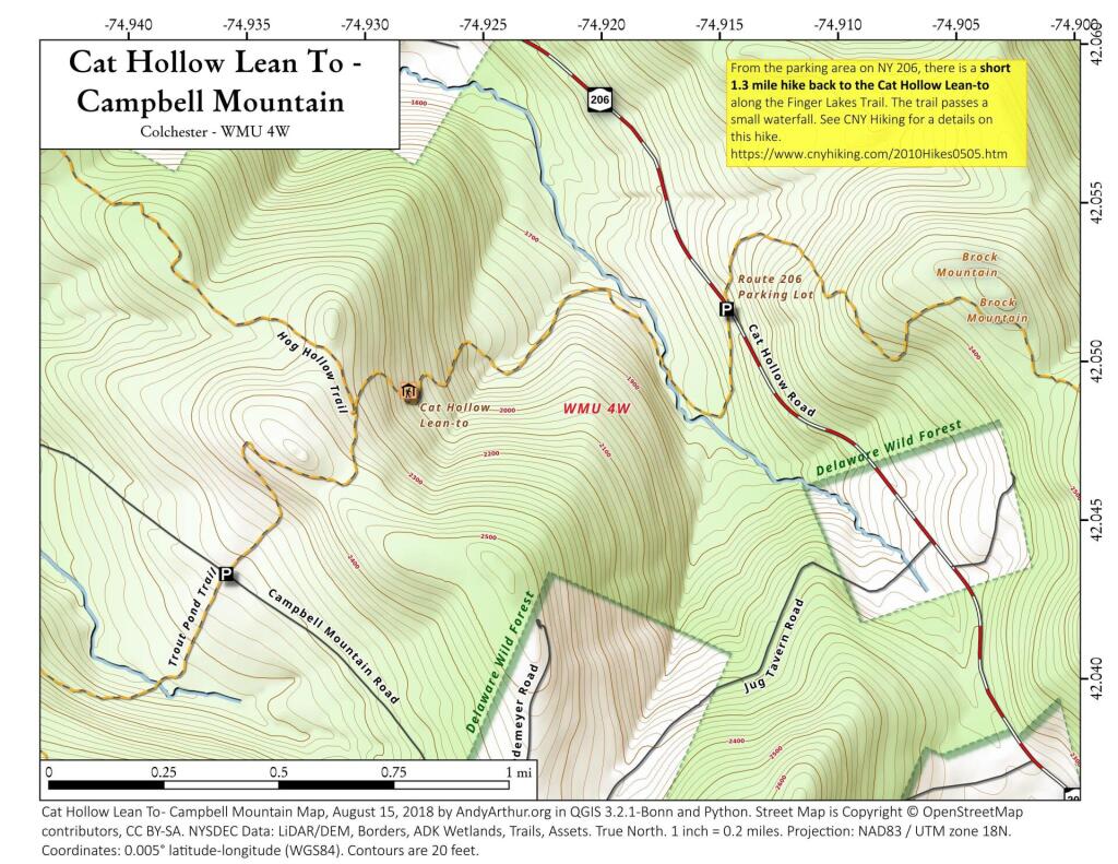
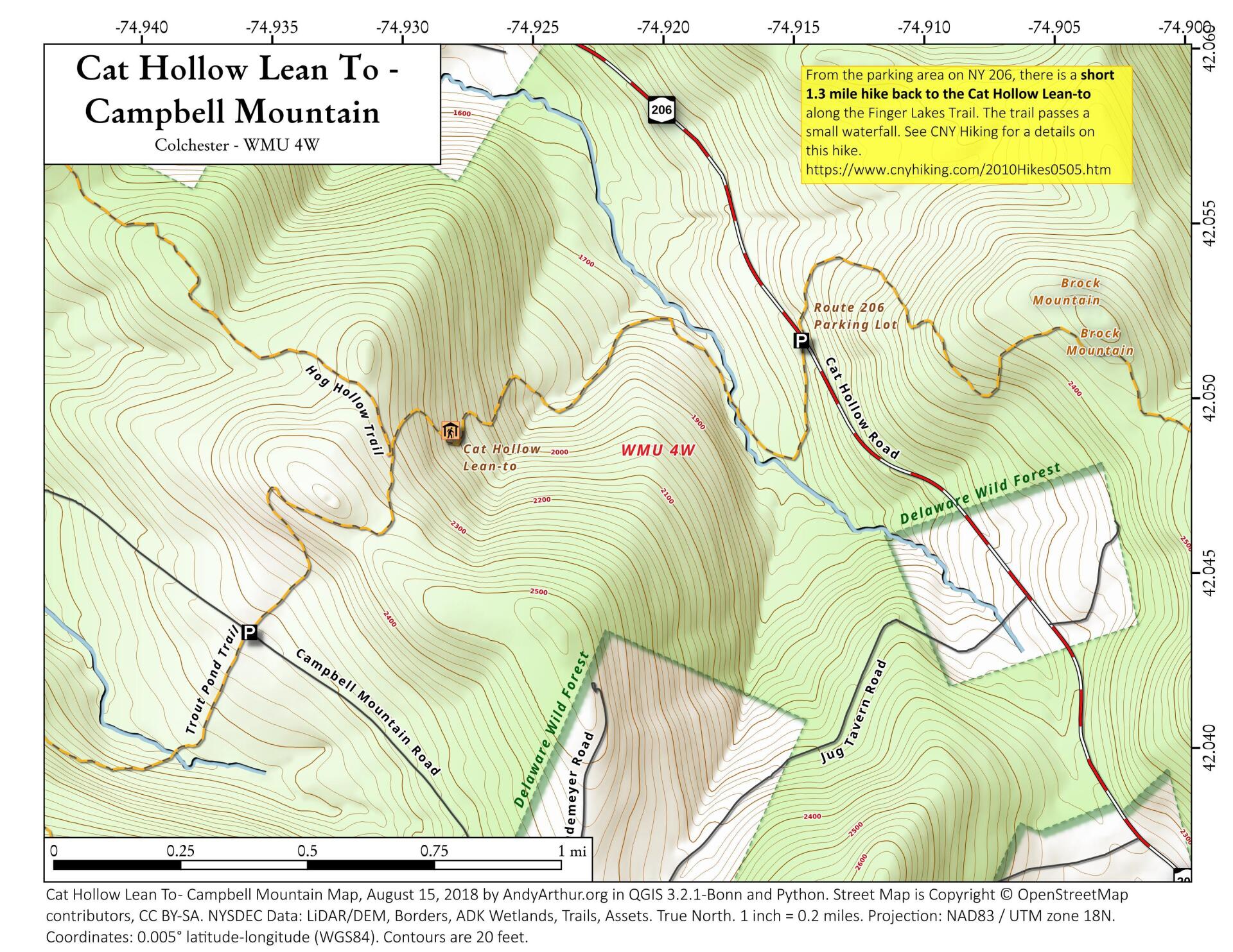
Cat Hollow Lean-to and Campbell Mountain
Download a High Resolution JPEG Image of the Cat Hollow Lean-to and Campbell Mountain or an Adobe Acrobat Printable PDF of the Cat Hollow Lean-to and Campbell Mountain.


Bookmark my free Interactive GPS Map for your phone:
https://andyarthur.org/ny
... shows your location as a blue dot in relationship to campsites, trails, state land. This online map requires cell service, won't work in remote country, so also bring a paper map.
Free Download of New & Historical USGS 1:24k Topograpic Maps
Interactive maps with backcountry and roadside camping: New York, Pennsylvania, West Virginia & Vermont. List of NYS DEC Lean-Tos and Firetowers.
Google Spreadsheet with Roadside, Primitive and Pay Campsites
More about Delaware Wild Forest...
The Delaware Wild Forest is comprised of 27,800 acres of Forest Preserve land in the western-most part of the Catskill Park, falling within the counties of Delaware, Sullivan and Ulster. The unit is characterized by mountainous terrain, with grades ranging from moderate to steep. Approximately 33 miles of foot trails and 22 miles of snowmobile trails run through the Delaware Wild Forest, and ample opportunity for other recreational opportunities and solitude exist within the unit as well.
http://www.dec.ny.gov/lands/51914.html
http://www.dec.ny.gov/lands/50658.html
Download the PDF Map Pack with All Maps from Delaware Wild Forest.


