Tupper Lake (North)
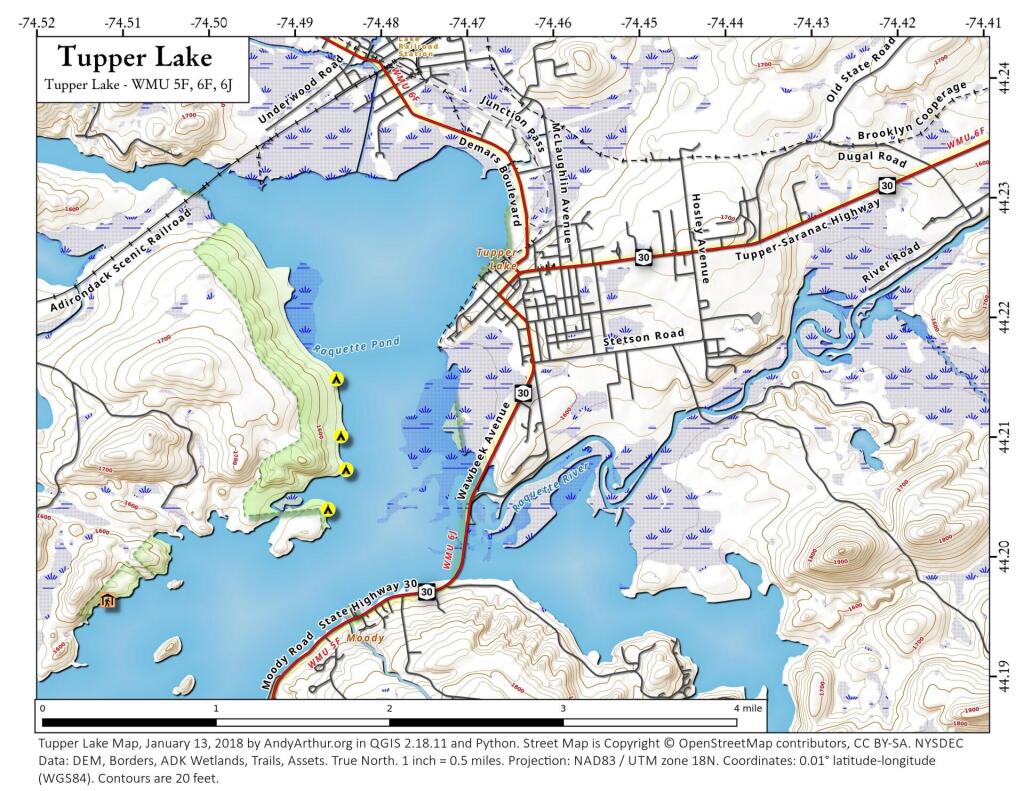
This map shows the northern portion of Tupper Lake near the village. There are a handful of campsites on state land along the west shore of the lake, along with some along the south shore of the lake (not shown).

This map shows the northern portion of Tupper Lake near the village. There are a handful of campsites on state land along the west shore of the lake, along with some along the south shore of the lake (not shown).

Back when the village was a bit smaller and the current alignment NY 30 down to Long Lake didn't really exist in the current form.

Old NY 10 running on the east side of Goodman Mountain couldn't have been in use very long as it's not seen on the 1907 USGS topographic maps and by the mid-1950s has already been by-passed in favor of the modern western alignment along the lake.