Change in Agricultural Land Use, 2001-2019
While tillage is up in the Lake Ontario plains and northern Finger Lakes due to more dairy, the decline in dairy in other parts of state means a lot of farm land that was once cultivated is now used for hay and grazing for beef cattle.


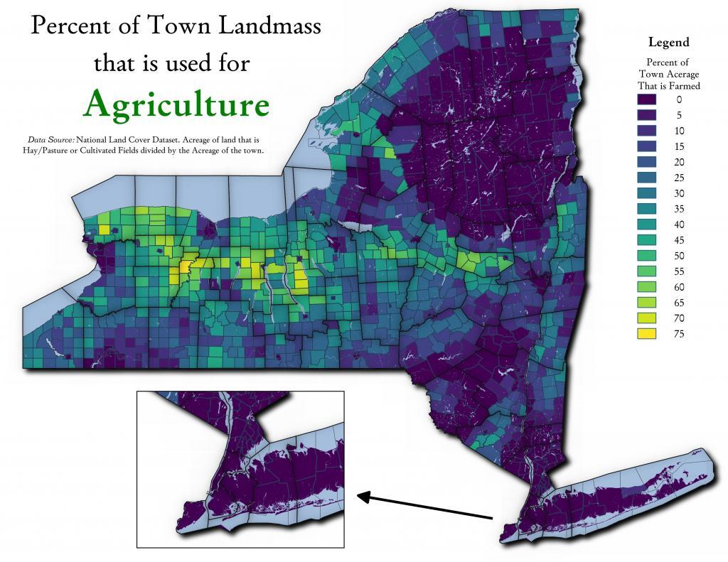
Percent of Town Landmass Used for Agriculture
One thing that is misleading with the table I just shared is some towns are larger then others. Some towns have a lot of farm acerage, because they are big towns in area. This map shows the percentage of town landmass used for agriculture - including field crops and forage production.