Out to the Hudson River
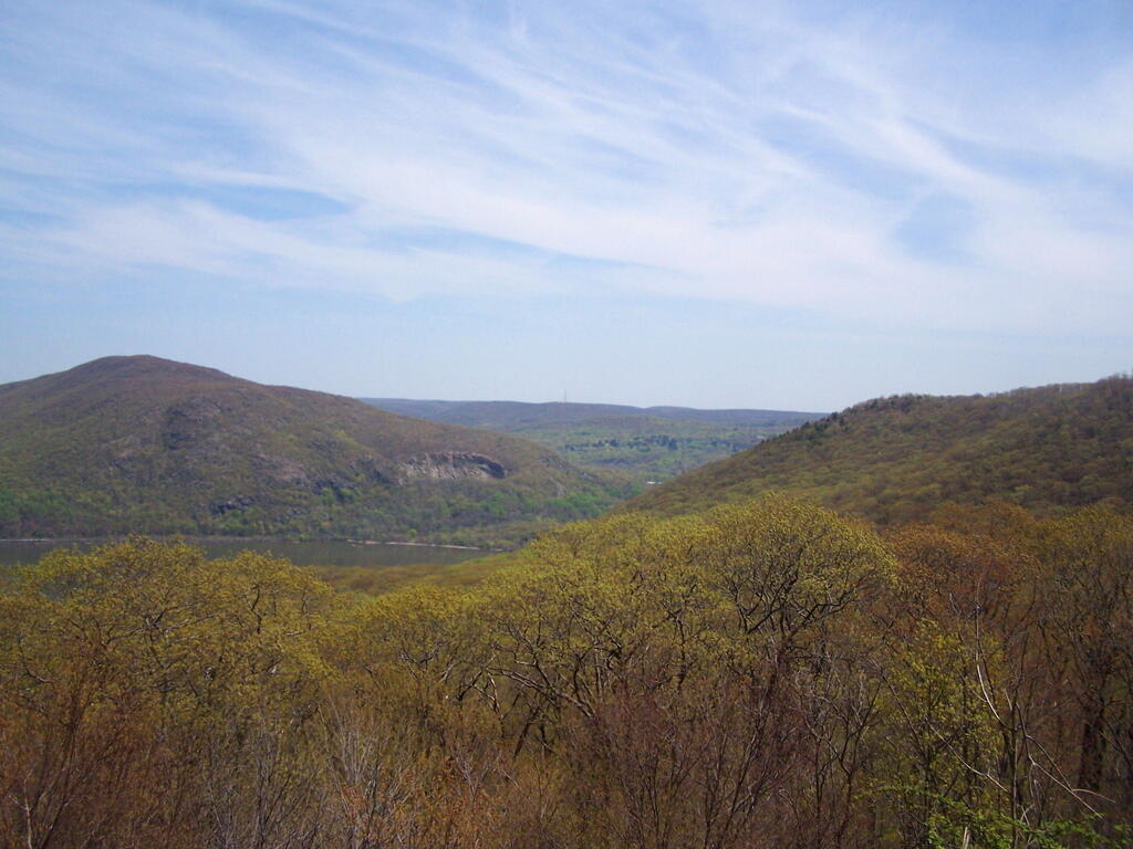
Looking off the side of Buttermilk Hill as I was hiking at Storm King Mountain a few years back.
Tuesday April 22, 2008 — Storm King Mountain
Looking off the side of Buttermilk Hill as I was hiking at Storm King Mountain a few years back.
Tuesday April 22, 2008 — Storm King Mountain

I like this graffiti painted on the rock. it's cute.
Tuesday April 22, 2008 — Storm King Mountain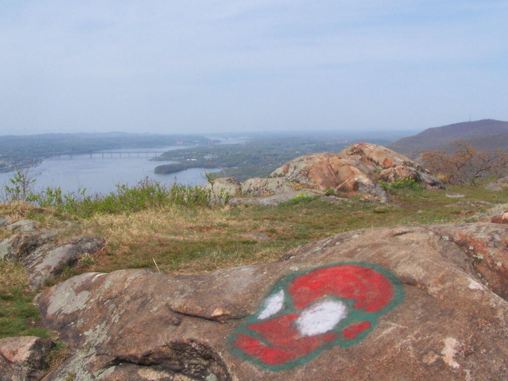
The construction of this bypass in 1938 created a great deal of controversy by people who thought it would detract from the scenic beauty of Storm King and the original Storm King highway.
Tuesday April 22, 2008 — Storm King Mountain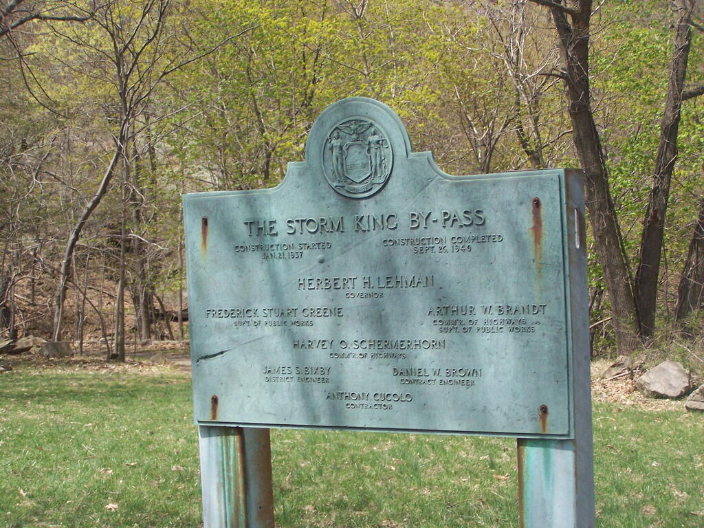

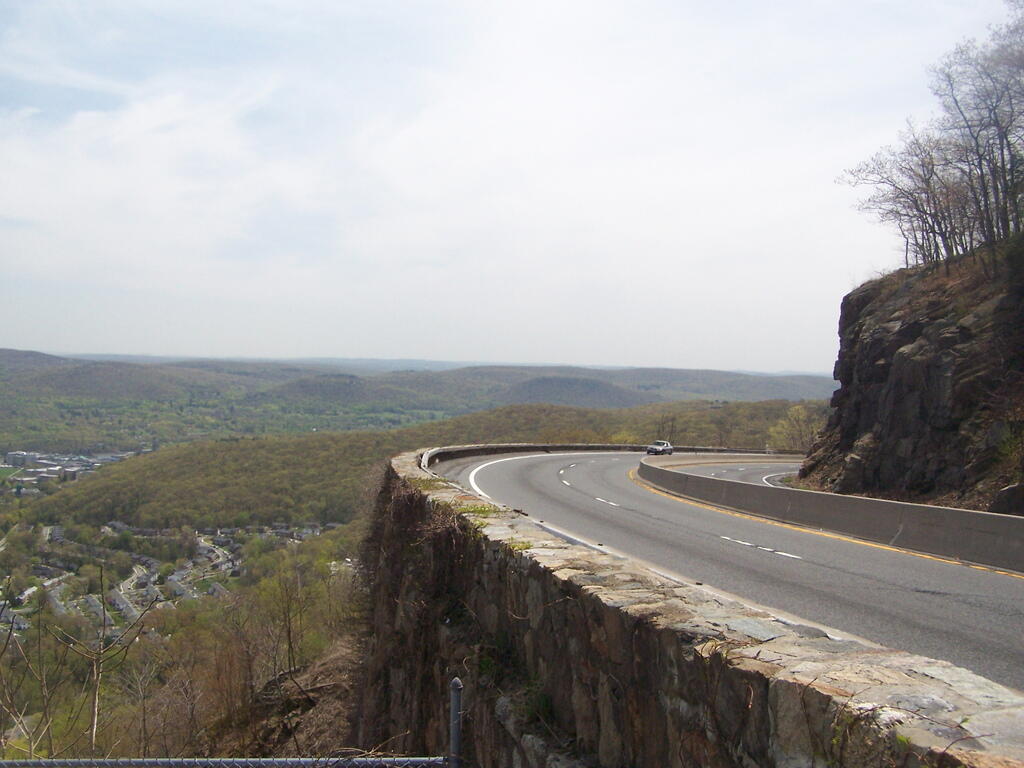
The storm king highway has many sweeping curves and cuts into the mountain. It wouldn't comply with modern highway standards but is pretty remarkable to look at.
Tuesday April 22, 2008 — Storm King Mountain