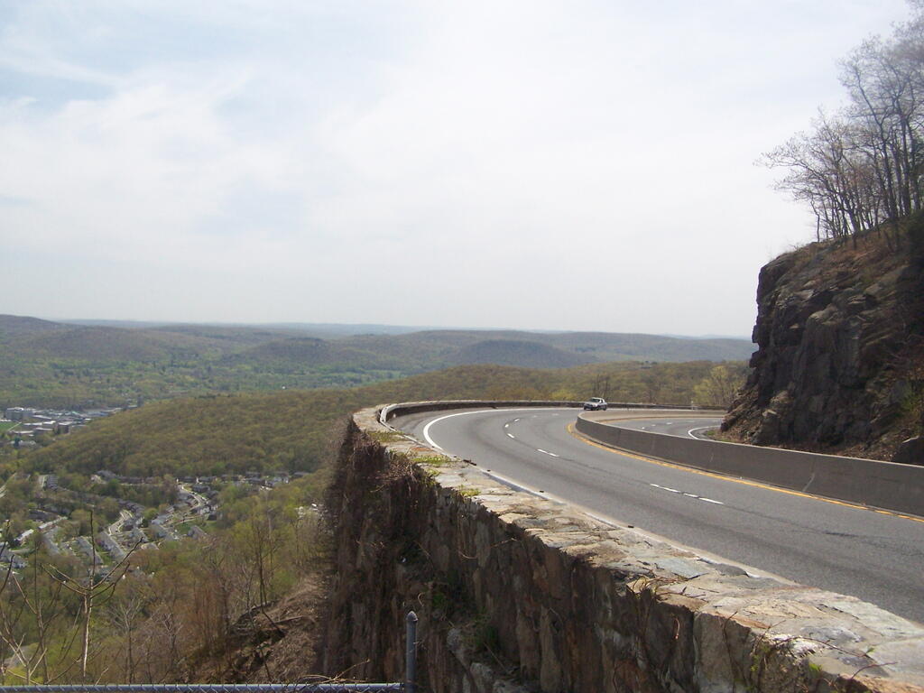
On the Edge of Storm King 🖼️
Download a JPEG Image of the On the Edge of Storm King.
On the Edge of Storm King ...
The storm king highway has many sweeping curves and cuts into the mountain. It wouldn't comply with modern highway standards but is pretty remarkable to look at.
Taken on Tuesday April 22, 2008 at Storm King Mountain.

More about Storm King Mountain...
Storm King Mountain is along the west bank of the Hudson River south of Cornwall-on-Hudson, New York.
Together with Breakneck Ridge on the opposite bank of the river it forms "Wey-Gat" or Wind Gate, the picturesque northern gateway to the Hudson Highlands. Its distinctive curved ridge is the most prominent aspect of the view south down Newburgh Bay, from Newburgh, Beacon, and the Newburgh-Beacon Bridge.
Storm King State Park offers unsurpassed views of the Catskills and the Hudson Valley. Hikers and hunters enjoy this undisturbed green space. Park is undeveloped. There are no toilets and limited parking.
http://en.wikipedia.org/wiki/Storm_King_Mountain_%28New_York%29
http://nysparks.com/parks/152/details.aspx


