New York State 📍
🗺️ Maps

Dunning Pond Trail
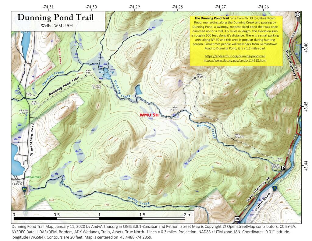
The Dunning Pond Trail runs from NY 30 to Gillmantown Road, mendaring along the Dunning Creek and passing by Dunning Pond, a swampy, modest-sized pond that was once dammed up for a mill. 4.5 miles in length, the elevation gain is roughly 600 feet along it's distance. There is a small parking area along NY 30 and this area is popular during hunting season. Sometimes people will walk back from Gilmantown Road to Dunning Pond, it is a 1.2 mile road.
https://andyarthur.org/dunning-pond-trail
https://www.dec.ny.gov/lands/114618.html



Fishbrook Pond
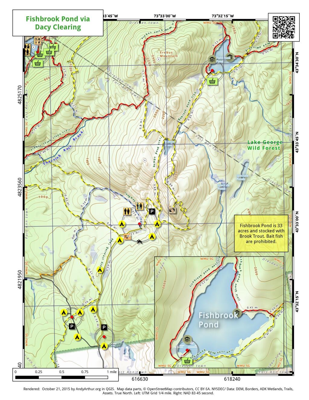
Here is a map of Fishbrook Pond, as accessed via trails around Dacy Clearing Road. Fishbrook Pond is 33 acres with a lean-to and picnic area. On the way there is Sleeping Beauty Mountain along with several campsites and other facilities.