Jessup River Wild Forest 📍

The Jessup River Wild Forest (JRWF) area consists of 47,350 acres of State Forest Preserve lands in the towns of Arietta, Indian Lake, Lake Pleasant, and Wells in Hamilton County. The unit is bounded by Route 28 to the north and Route 30 in the southeast, as well as three wilderness areas: West Canada Lakes Wilderness to the west; Siamese Ponds Wilderness to the east, and Silver Lake Wilderness to the south. The state lands in this unit border, or are in close proximity to, the communities of Indian Lake, Piseco, Speculator and Wells. Route 30 bisects the unit and serves as the main access corridor. Many people enjoy hiking to the fire towers on Pillsbury and Snowy mountains, snowmobiling between Piseco Lake and Indian Lake, canoeing on Fall Stream, or camping on Mason Lake. Hunting, fishing, and trapping are also popular activities throughout the unit but particularly in and around Perkins Clearing, the Jessup River and the Miami River.

http://www.dec.ny.gov/lands/22599.html

Download the PDF Map Pack
🗺️ Maps 🖼️ Photos 📽️ Videos

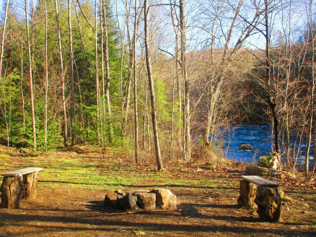
Robb Creek Mill Campsite

I believe is the infamous campsite, which is located on the Sacandaga River near where Robb Creek runs into it. But regardless, it is a beautiful tent site on the river, a short driveway down from the Old Route 8B.

Monday April 26, 2021 — Perkins Clearing and Speculator Tree Farm Conservation Easement LandsJessup River Road - Perkins Clearing - Campsites and Mason Lake Access 🗺Kunjamunk Cave 🗺Old Route 8B - Austin Falls - Robbs Creek - Camping 🗺PDF with All Maps 📚
SVGZ Graphic: Change in Median Age - County Subdivision
Map: Mountain House Trail and North Mountain
Thematic Map: Pine Bush 1927
Map: Empire State Topography

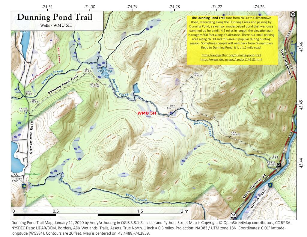
Dunning Pond Trail

The Dunning Pond Trail runs from NY 30 to Gillmantown Road, mendaring along the Dunning Creek and passing by Dunning Pond, a swampy, modest-sized pond that was once dammed up for a mill. 4.5 miles in length, the elevation gain is roughly 600 feet along it's distance. There is a small parking area along NY 30 and this area is popular during hunting season. Sometimes people will walk back from Gilmantown Road to Dunning Pond, it is a 1.2 mile road.


https://andyarthur.org/dunning-pond-trail
https://www.dec.ny.gov/lands/114618.html

 Dunning Pond Trail

Map: Applachian Region Of New York State