
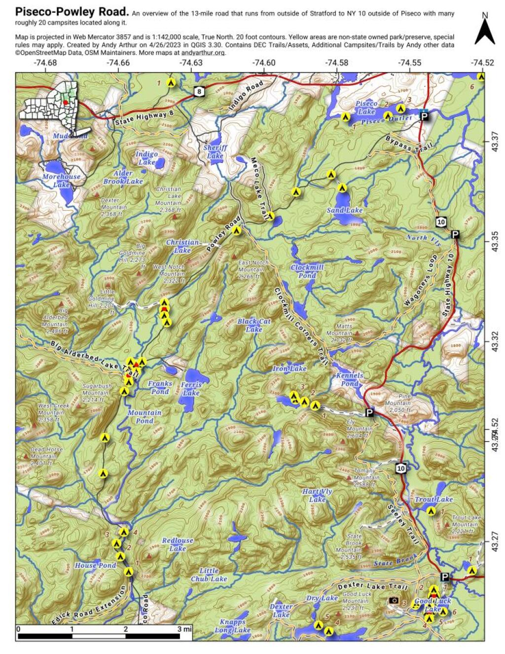
Overview Map Piseco-Powley Road
This Overview Map of Piseco-Powley Road shows the campsites along the road, along with major trails and destinations along the road.

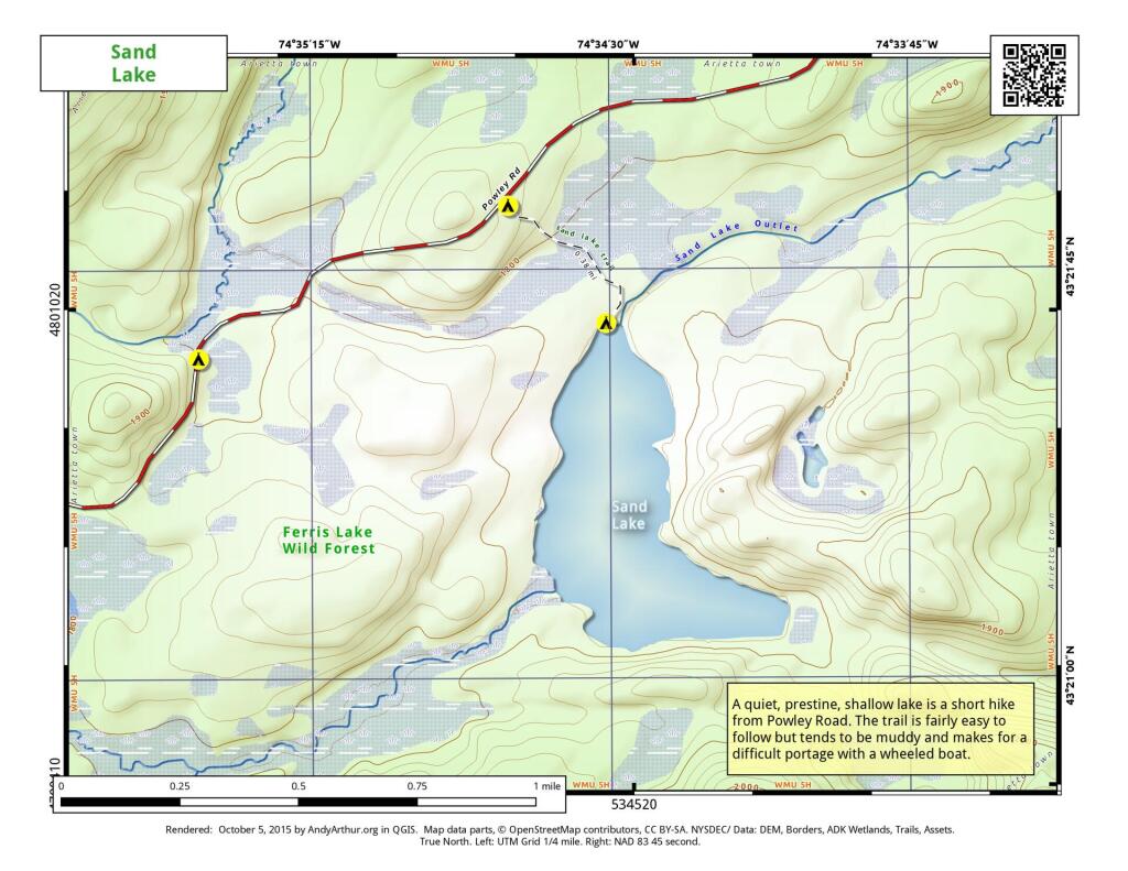
Sand Lake
Sand Lake is a 1/3rd of a mile away from Piseco Powley Road. The trail is somewhat overgrown and marshy, so a paddle cart won't work for well for carrying a boat back here, but with another person you should be able to get back here.