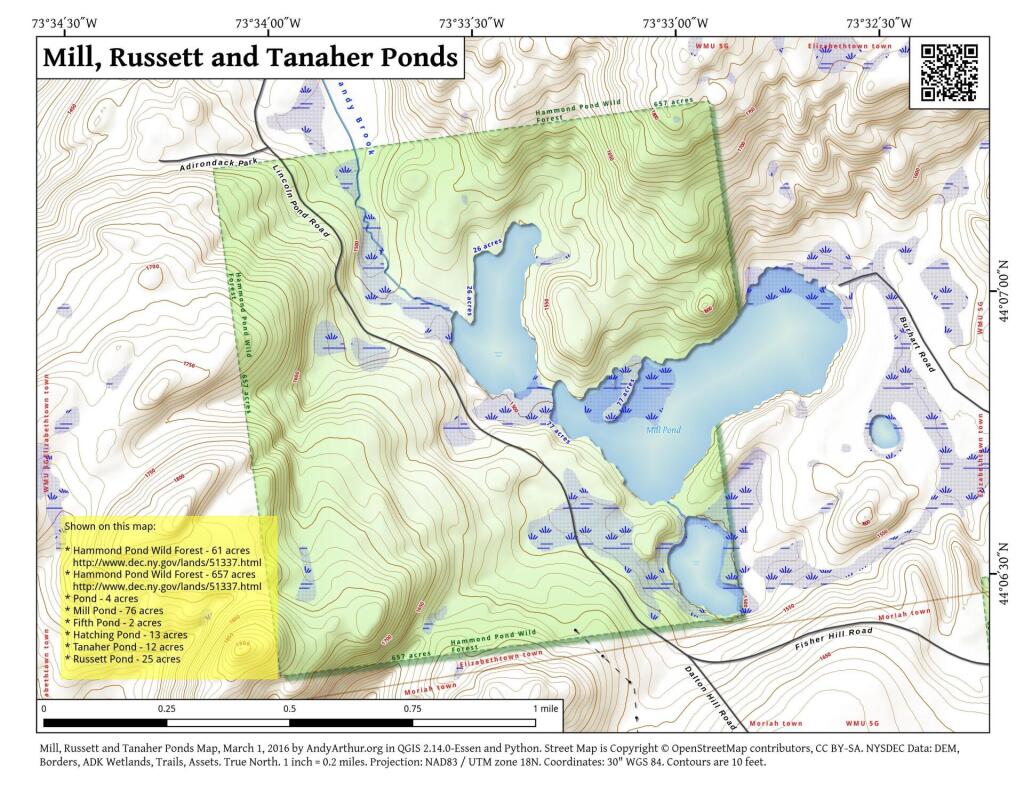
Russett and Mill Ponds
You can't see Lincoln Pond from Belfry. In the distance is Hurricane Mountain and Jay Mountain.
Sunday January 27, 2013 — Belfry Mountain Firetower — Belfry Mountain Firetower 🗺
You can't see Lincoln Pond from Belfry. In the distance is Hurricane Mountain and Jay Mountain.
Sunday January 27, 2013 — Belfry Mountain Firetower — Belfry Mountain Firetower 🗺

Notice the ice shanties in the distance.
Sunday January 27, 2013 — Cheney Mountain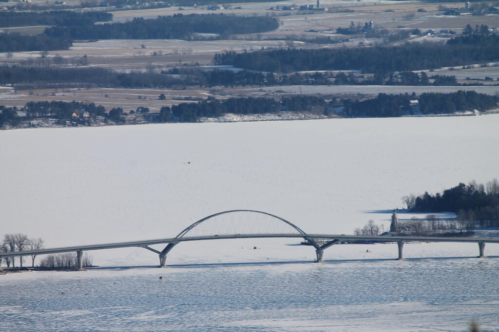
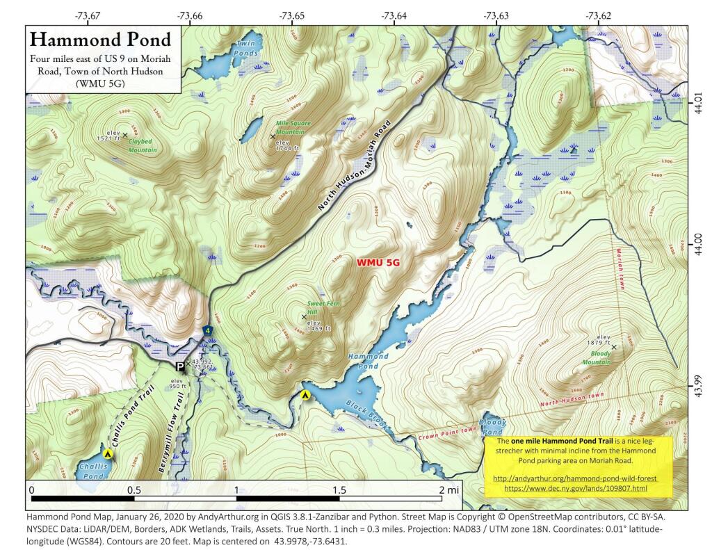
The one mile Hammond Pond Trail is a nice leg-strecher with minimal incline from the Hammond Pond parking area on Moriah Road.
http://andyarthur.org/hammond-pond-wild-forest
https://www.dec.ny.gov/lands/109807.html

I rarely get up that way in the Adirondacks because I don’t like driving on the Adirondack Northway, but there could be a lot to explore up that way, even if they’re isn’t the roadside camping nearby — unless I head back along Boreas Road and camp at one of sites along Boreas Road or NY 28N. That might actually be fun and hike the Roosevelt Truck Trail the next day.
Back in 2020, I hiked back to Hammond Pond. While I was there, I thought it looks interesting to hike back to Berrymill Flow and Moose Mountain Pond. I could stay at the lean-to there or in my hammock overnight. None of those hikes look particularly strenuous, and I think because they’re not mountain tops and are in remote country, they’re probably not super popular either. I would like to spend more time in the remote country, and with my rechargable lantern and battery pack, I probably wouldn’t need a big heavy lantern, and during the summer months could pack lightly, possibly without a big heavy pack frame — or at least not so heavily weighted down.