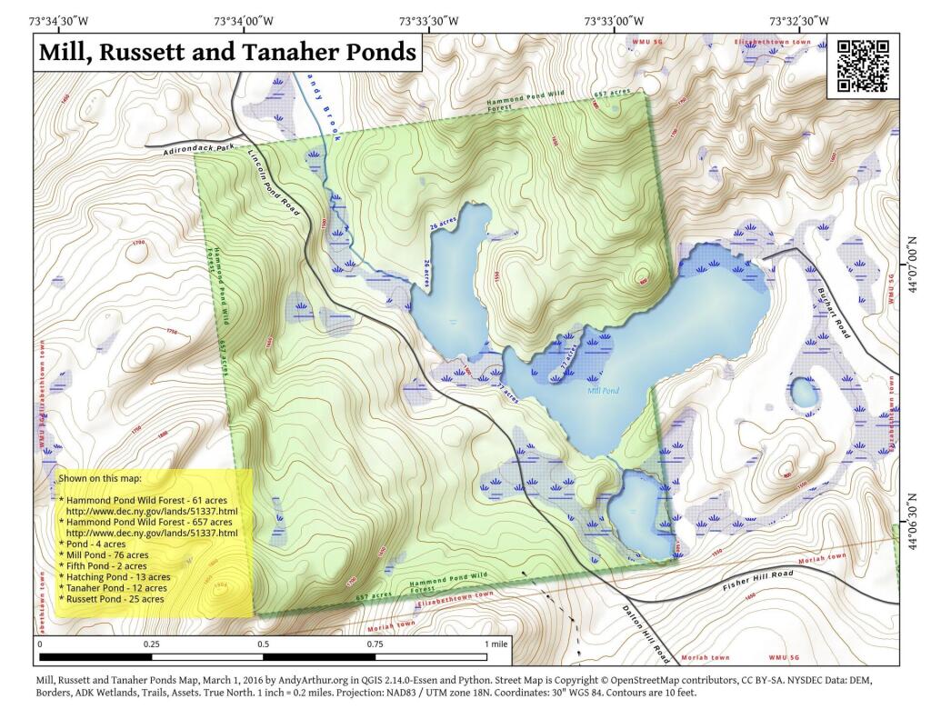
Mill, Russett And Tanaher Ponds
Download a High Resolution JPEG Image of the Mill, Russett And Tanaher Ponds or an Adobe Acrobat Printable PDF of the Mill, Russett And Tanaher Ponds.


Bookmark my free Interactive GPS Map for your phone:
https://andyarthur.org/ny
... shows your location as a blue dot in relationship to campsites, trails, state land. This online map requires cell service, won't work in remote country, so also bring a paper map.
Free Download of New & Historical USGS 1:24k Topograpic Maps
Interactive maps with backcountry and roadside camping: New York, Pennsylvania, West Virginia & Vermont. List of NYS DEC Lean-Tos and Firetowers.
Google Spreadsheet with Roadside, Primitive and Pay Campsites
More about Hammond Pond...
The Hammond Pond Wild Forest is located in the northeastern Adirondacks and the Lake Champlain Basin of Essex County. There are approximately 40,036 acres in the unit, which is situated in the Towns of Crown Point, Elizabethtown, Moriah, North Hudson, Schroon, Ticonderoga, and Westport.
http://www.cnyhiking.com/HammondPondWildForest.htm
Download the PDF Map Pack with All Maps from Hammond Pond.


