What is a Primitive Tent Site?
The Adirondack Park State Land Master Plan describes primative tent sites as follows:
25. Primitive Tent Site–a designated tent site of an undeveloped character providing space for not more than three tents, which may have an associated pit privy and fire ring, designed to accommodate a maximum of eight people on a temporary or transient basis, and located so as to accommodate the need for shelter in a manner least intrusive on the surrounding environment. (page)
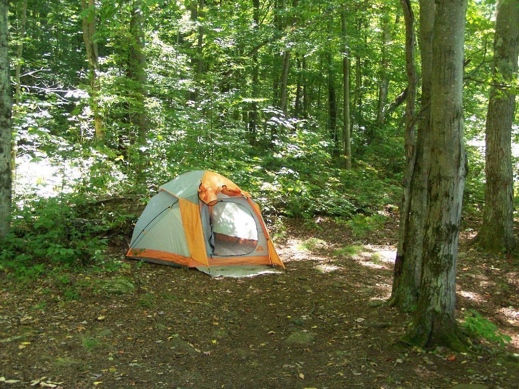
The Adirondack State Land Master Plan uses the definition of a “primitive tent site” in a wilderness area to explain campsites in wild forest.
1. All structures and improvements permitted under the guidelines covering wilderness areas will be allowed in wild forest areas. […]
Here is the wilderness “primitive tent site” regulations per the APSLMP:
1. The structures and improvements listed below will be considered as conforming to wilderness standards and their maintenance,rehabilitation and construction permitted:
— primitive tent sites below 3,500feet in elevation that are out of sight andsound and generally one-quarter mile from any other primitive tent site or lean-to:
(i) where physical and biological conditions are favorable, individual unit management plans may permit th establishment, on a site-specific basis, of primitive tent sites between 3,500 and 4,000feet in elevation, and,
(ii) where severe terrain constraints prevent the attainment of the guideline for a separation distance of generally one-quarter mile between primitive tent sites, individual unit management plans may provide, on a site-specific basis, for lesser separation distances, provided such sites remain out of sight and sound from each other, be consistent with the carrying capacity of the affected area and are generally not less than500 feet from any other primitive tent site;
Also, in wild forest, so-called groups of primitive campsites are allowed:
Small groupings of primitive tent sites designed to accommodate a maximum of 20people per grouping under group camping conditions may be provided at carefully selected locations in wild forest areas, even though each individual site may be within sight or sound and less than approximately one-quarter mile from any other site within such grouping, subject to the following criteria:
— such groupings will only be established or maintained on a site specific basis in conformity with a duly adopted unit management plan for the wild forest area in question;
— such groupings will be widely dispersed (generally a mile apart) and located in a manner that will blend with the surrounding environment and have a minimum impact on the wild forestcharacter and natural resource quality of thearea;
— all new, reconstructed or relocated tent sites in such groupings will beset back a minimum of 100 feet from themean high water mark of lakes, ponds,rivers and major streams and will be located so as to be reasonably screened from the water body to avoid intruding on the natural character of the shoreline and the public enjoyment and use thereof.
Despite threats from PROTECT! and Residents Committee to Protect the Adirondacks, the Adirondack State Land Master Plan has never been litigated in court, so there is no legal interpretations of the ASLMP outside what has been decided by the DEC and Adirondack Park Agency.
Many different wild forests have taken that definition to different meanings…
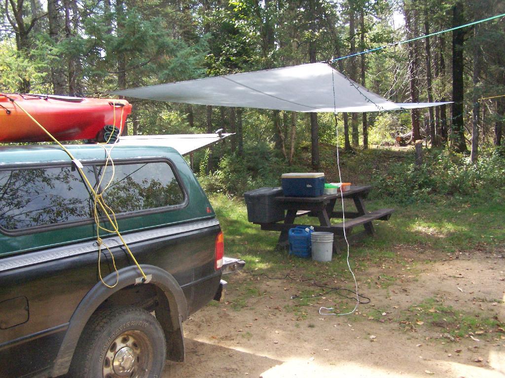
Generally Open to All Campers…
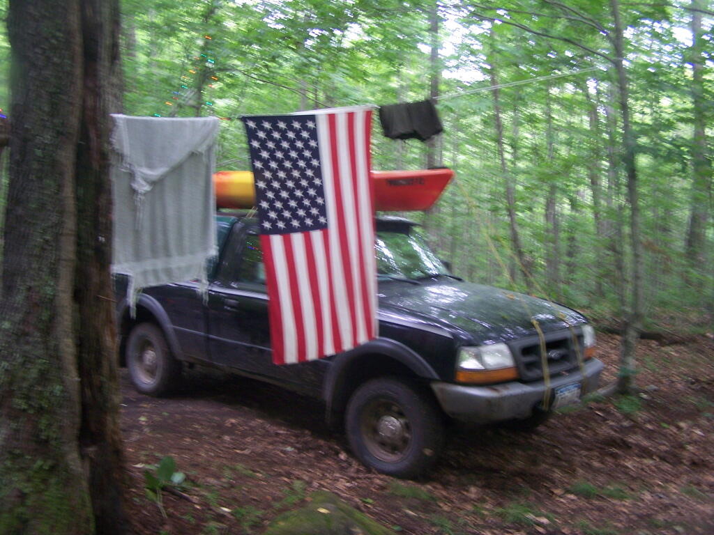
At Ferris Lake Wild Forest, particularly on Piseco-Powley Road, it has been taken to mean roadside campsites, where vehicles can access, and people are free to bring in a pickup camper or recreational vehicle if they so choose. Indeed, the draft UMP and the Adirondack State Land Master Plan both mention roadside camping. The Ferris Lake UMP goes as far as to describe various sites, and how big of a vehicle can fit in individual campsites. The sites have fire rings and outhouses, which is consistent with that definition. A minority of sites also have picnic tables.
This is common in most wild forests with roadside campsites, including Black River Wild Forest (North Lake, Woodhull Lake), Debar Mountain (Mountain Pond, Jones Pond, etc.), Ferris Lake Wild Forest (Powley Road, G-Lake Road, Edick Road, Mountain Road, etc.), Moose River Plains, and Vanderwhacker Wild Forest (Moose Club Way, Northwoods Club Road, NY 28N, Cheney Pond, Blue Ridge Road), Wilcox Lake Wild Forest (NY 8, Pumpkin Hollow, Hope Falls, etc.).
Tent Site Use Only…
On the polar opposite would be Lake George Wild Forest, particularly along Darcy Clearing Road and Hogstown Road, where all of the campsites have been relocated and blocked off to prevent any vehicle use or non-tent use. The argument here is that primitive tent site must be taken literally in the dictionary sense, and that any use of vehicles, such as truck campers or recreational vehicles are inconsistent with the Adirondack Park State Land Master Plan.
Similar policies on restricting use of motor vehicles in roadside campsites exist in a minority of other wild forest campsites (like the lower portion of Harrietstown Road and Garnet Lake in Wilcox Lake Wild Forest), however the majority of forests allow some roadside campsites, with vehicle access.
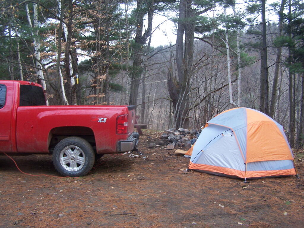
History Looms Large.
But let’s be honest, most wild forests allow unrestricted roadside campsites for a variety of vehicles, including pickup campers and recreational facilities. This has been going on for over 100 years, basically as long as their has been motor vehicles in the Adirondacks, and certainly as long as recreational vehicles and truck campers have existed. Most public lands, outside of NY State also do not have much in restrictions on roadside camping.
It’s tough to take away from people what they are already granted, and enjoy, especially if the rational is limited. People enjoy roadside camping in a variety of vehicles, and in many locations. For many people, they have been coming to the backcountry for decades, parking their truck or RV, and enjoying all of the solitude and pleasure that roadside camping.
Land Use Classifications in Adirondack Forest Preserve
These definitions are from the Adirondack Park State Land Master Plan.
Wild Forest.
A wild forest area is an area where the resources permit a somewhat higher degree of human use than in wilderness, primitive or canoe areas, while retaining an essentially wild character. A wild forest area is further defined as an area that frequently lacks the sense of remoteness of wilderness, primitive or canoe areas and that permits a wide variety of outdoor recreation.
To the extent that state lands classified as wild forest were given or devised to the state for silvicultural or wildlife management purposes pursuant to statutory provisions specifying that these lands will not form part of the forest preserve (if such provisions are constitutional), the following guidelines are not to be interpreted to prevent silvicultural or wildlife management practices on these lands, provided that other guidelines for wild forest land are respected.
Those areas classified as wild forest are generally less fragile, ecologically, than the wilderness and primitive areas. Because the resources of these areas can withstand more human impact, these areas should accommodate much of the future use of the Adirondack forest preserve. The scenic attributes and the variety of uses to which these areas lend themselves provide a challenge to the recreation planner. Within constitutional constraints, those types of outdoor recreation that afford enjoyment without destroying the wild forest character or natural resource quality should be encouraged.
Many of these areas are under-utilized. For example the crescent of wild forest areas from Lewis County south and east through Old Forge, southern Hamilton and northern Fulton Counties and north and east to the Lake George vicinity can and should afford extensive outdoor recreation readily accessible from the primary east-west transportation and population axis of New York State.
Wilderness.
A wilderness area, in contrast with those areas where man and his own works dominate the landscape, is an area where the earth and its community of life are untrammeled by man–where man himself is a visitor who does not remain.
A wilderness area is further defined to mean an area of state land or water having a primeval character, without significant improvement or permanent human habitation, which is protected and managed so as to preserve, enhance and restore, where necessary, its natural conditions, and which:
(1) generally appears to have been affected primarily by the forces of nature, with the imprint of man’s work substantially unnoticeable;
(2) has outstanding opportunities for solitude or a primitive and unconfined type of recreation;
(3) has at least ten thousand acres of contiguous land and water or is of sufficient size and character as to make practicable its preservation and use in an unimpaired condition; and (4) may also contain ecological, geological or other features of scientific, educational, scenic or historical value.
Significant portions of the state lands within the Park are in a wilderness or near-wilderness condition today. These areas constitute nearly 20% of all designated federal and state wilderness east of the Rocky Mountains and 85% of the designated wilderness in the eleven northeastern states. At the time of the original enactment of this master plan, a majority of these areas contained some structures and improvements or were subjected to uses by the public or by official personnel that were incompatible with wilderness. However, the extent of these non-conforming uses was very modest from the standpoint of the total acreage involved. Since 1972 all but a few of those non-conforming uses have been removed by the Department of Environmental Conservation.
Primative Area.
A primitive area is an area of land or water that is either:
1. Essentially wilderness in character but, (a) contains structures, improvements, or uses that are inconsistent with wilderness, as defined, and whose removal, though a long term objective, cannot be provided for by a fixed deadline, and/or, (b) contains, or is contiguous to, private lands that are of a size and influence to prevent wilderness designation; or,
2. Of a size and character not meeting wilderness standards, but where the fragility of the resource or other factors require wilderness management.
The definition recognizes two basic types of primitive areas: (i) where the ultimate goal is clearly to upgrade the area to wilderness at some future time, however distant, when the non-conforming uses can be removed and/or acquisition of private tracts is accomplished, and, (ii) where eventual wilderness classification is impossible or extremely unlikely.
An example of the first type would be the existence of a fire tower and associated structures and improvements (observer cabins, telephone lines, etc.) whose precise date of removal cannot be ascertained until the new aerial surveillance program of the Department of Environmental Conservation is fully implemented and communication systems modernized. Another example would be a private or minor public road traversing a tract otherwise suitable for wilderness designation or separating such an area from a designated wilderness. Finally, an extensive private inholding or a series of smaller private inholdings whose eventual acquisition is desirable but cannot now be provided for, might so affect a potential wilderness area as to require primitive designation.
The second type includes smaller tracts that are most unlikely to attain wilderness standards, such as a small island in close proximity to a highly developed shoreline, or larger tracts with non-conforming uses, such as a railroad or major public highway, that are essentially permanent, but where in each case the high quality or fragility of the resource requires wilderness management.
The definition recognizes two basic types of primitive areas: (i) where the ultimate goal is clearly to upgrade the area to wilderness at some future time, however distant, when the non-conforming uses can be removed and/or acquisition of private tracts is accomplished, and, (ii) where eventual wilderness classification is impossible or extremely unlikely.
An example of the first type would be the existence of a fire tower and associated structures and improvements (observer cabins, telephone lines, etc.) whose precise date of removal cannot be ascertained until the new aerial surveillance program of the Department of Environmental Conservation is fully implemented and communication systems modernized. Another example would be a private or minor public road traversing a tract otherwise suitable for wilderness designation or separating such an area from a designated wilderness. Finally, an extensive private inholding or a series of smaller private inholdings whose eventual acquisition is desirable but cannot now be provided for, might so affect a potential wilderness area as to require primitive designation.
The second type includes smaller tracts that are most unlikely to attain wilderness standards, such as a small island in close proximity to a highly developed shoreline, or larger tracts with non-conforming uses, such as a railroad or major public highway, that are essentially permanent, but where in each case the high quality or fragility of the resource requires wilderness management.
Canoe Area.
A canoe area is an area where the watercourses or the number and proximity of lakes and ponds make possible a remote and unconfined type of water-oriented recreation in an essentially wilderness setting.
The terrain associated with parcels meeting the above definition is generally ideally suited to ski touring and snowshoeing in the winter months.