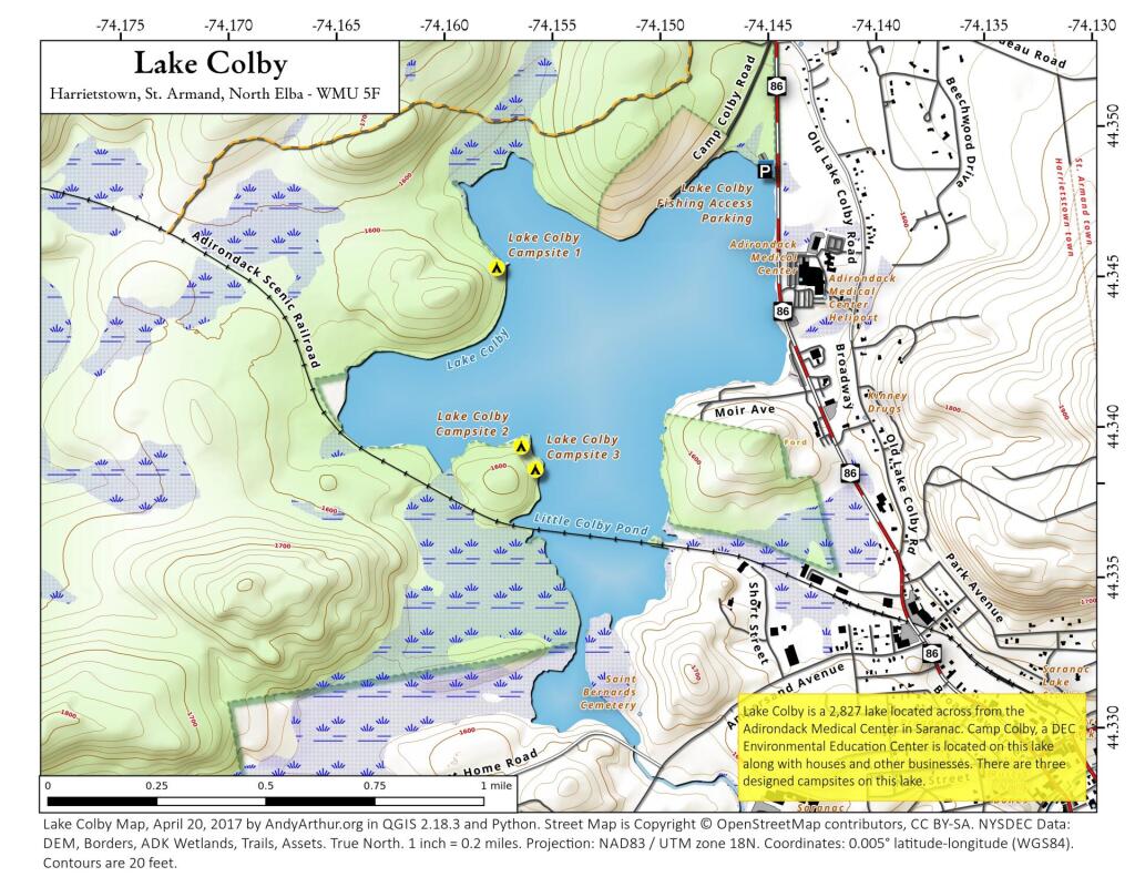
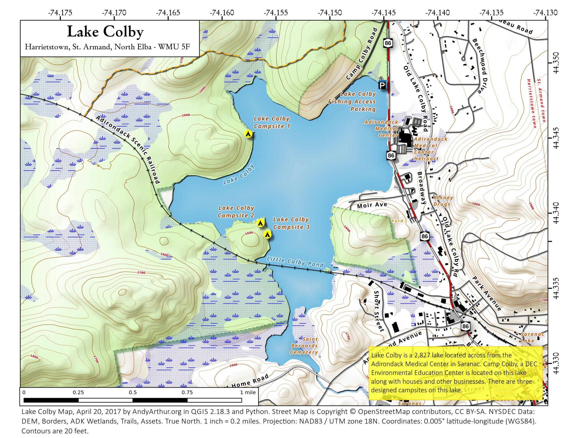
Lake Colby
Download a High Resolution JPEG Image of the Lake Colby or an Adobe Acrobat Printable PDF of the Lake Colby.


Bookmark my free Interactive GPS Map for your phone:
https://andyarthur.org/ny
... shows your location as a blue dot in relationship to campsites, trails, state land. This online map requires cell service, won't work in remote country, so also bring a paper map.
Free Download of New & Historical USGS 1:24k Topograpic Maps
Interactive maps with backcountry and roadside camping: New York, Pennsylvania, West Virginia & Vermont. List of NYS DEC Lean-Tos and Firetowers.
Google Spreadsheet with Roadside, Primitive and Pay Campsites
More about Saranac Lake Wild Forest...
The Saranac Lakes Wild Forest (SLWF) is 79,000 acres of state land in Franklin and Essex Counties. It is situated near the communities of Saranac Lake, Tupper Lake, and Lake Placid.
The unit offers many recreational opportunities, including but not limited to hiking, snowmobiling, snowshoeing, skiing, mountain biking, canoeing, hunting, and fishing. Popular hiking attractions include Scarface and Panther Mountains, Fernow Nature Trail, and the Lake Placid Peninsula Nature Trails.
Many people enjoy boating and camping on Upper, Middle and Lower Saranac Lakes.
Download the PDF Map Pack with All Maps from Saranac Lake Wild Forest.


