John Pond – Clear Pond Loop
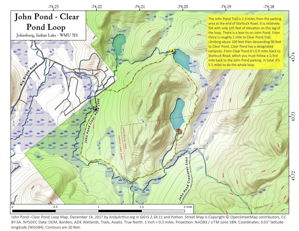
John Pond Trail extends 2.3 miles and ascends 145 feet from the John Pond trailhead to John Pond and a lean-to on the pond. The pond provides a scenic view of the small unnamed mountain that wraps around its shore. Clear Pond Trail extends 0.9 mile from the Clear Pond trailhead to the north end of Clear Pond. The trailhead can be accessed from the John Pond trailhead parking area by walking .35 mile on Starbuck Road. The trail climbs 330 feet for first 0.8 mile from the parking area before descending 90 feet to the pond. John Pond Crossover extends 3.4 miles from the John Pond Trail - 0.4 mile from John Pond - to the West Puffer Pond Trail - 1.5 miles from the King's Flow trailhead. Traveling from the John Pond Trail the trail ascends 365 feet and then descends 100 feet before reaching the West Puffer Pond Trail.