Stissing Mountain Multiple Use Area

Download a High Resolution JPEG Image of the Stissing Mountain Multiple Use Area or an Adobe Acrobat Printable PDF of the Stissing Mountain Multiple Use Area.


Bookmark my free Interactive GPS Map for your phone:
https://andyarthur.org/ny
... shows your location as a blue dot in relationship to campsites, trails, state land. This online map requires cell service, won't work in remote country, so also bring a paper map.
Free Download of New & Historical USGS 1:24k Topograpic Maps
Interactive maps with backcountry and roadside camping: New York, Pennsylvania, West Virginia & Vermont. List of NYS DEC Lean-Tos and Firetowers.
Google Spreadsheet with Roadside, Primitive and Pay Campsites
More about Stissing Mountain...
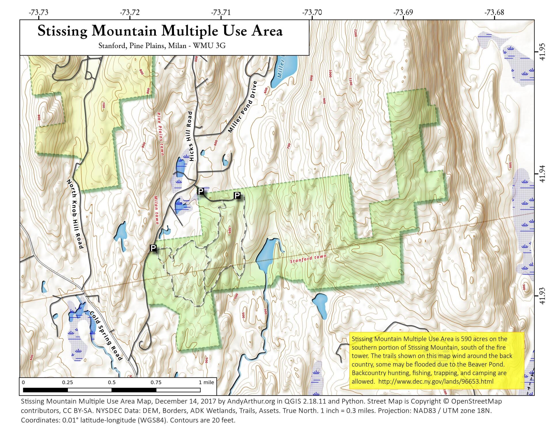
Stissing Mountain Multiple Use Area consists of 590 acres in the Tows of Milan, Pine Plains, and Stanford in Dutchess County.
Nearby is the Stissing Fire Tower stands on one acre of ground, both of which are owned by Friends of Stissing Landmarks (FOSL), a not-for-profit organization created to save and preserve the tower for public enjoyment.
The shortest and easiest point of access is from Lake Road in Pine Plains, just down from the Thompson Pond Preserve entrance on the bend of the road. The ascent to the tower begins by crossing approximately 100 yards of Nature Conservancy property, after which the trails cross private property all the way to the tower.
http://hikethehudsonvalley.com/stissing-mountain/
http://www.nynjtc.org/hike/stissing-mountain


