Elkdale State Forest

Download a High Resolution JPEG Image of the Elkdale State Forest or an Adobe Acrobat Printable PDF of the Elkdale State Forest.
")

Bookmark my free Interactive GPS Map for your phone:
https://andyarthur.org/ny
... shows your location as a blue dot in relationship to campsites, trails, state land. This online map requires cell service, won't work in remote country, so also bring a paper map.
Free Download of New & Historical USGS 1:24k Topograpic Maps
Interactive maps with backcountry and roadside camping: New York, Pennsylvania, West Virginia & Vermont. List of NYS DEC Lean-Tos and Firetowers.
Google Spreadsheet with Roadside, Primitive and Pay Campsites
More about Elkdale State Forest...
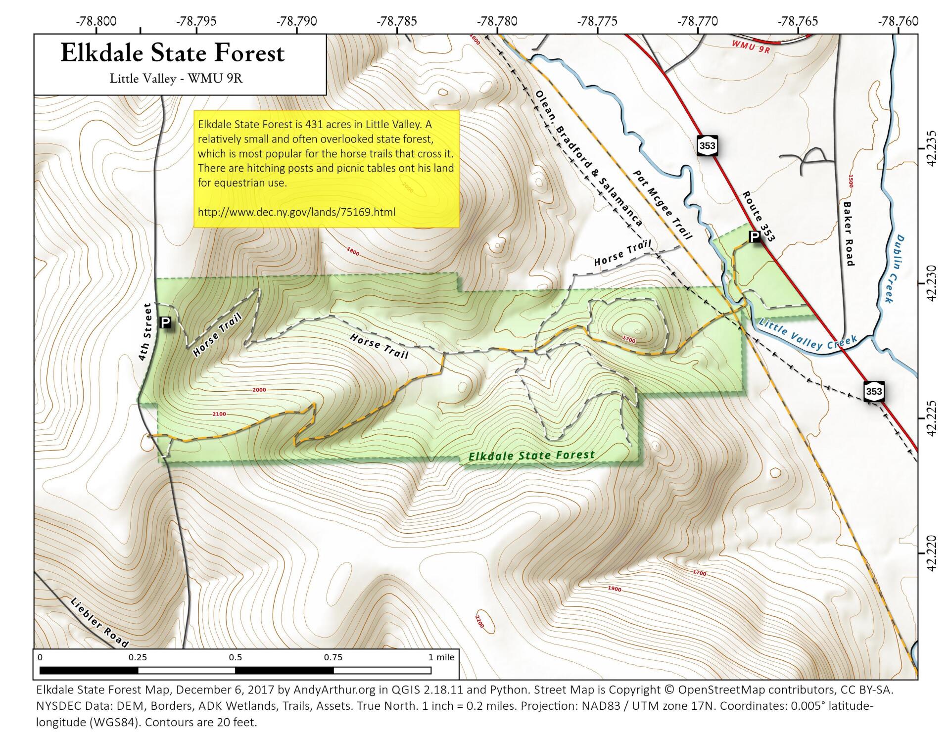
The 422-acre Elkdale State Forest is used as a base for the Operations Unit of DEC. This is the building complex you see on the grounds from Route 353. This property appears to be mostly old farm land - a house was located where the Operations Facility is today. Historically, two railroad lines crossed this property. One of these can be still be seen and is a section of the Rails-to-Trails corridor. The other has filled in with brush and is barely noticeable today.
No Comments
Thanks for all your hard work posting these maps! I’m going to check this trail out soon. I don’t live too far from here. Cheers Andy!!