Horseshoe Lake

Download a High Resolution JPEG Image of the Horseshoe Lake or an Adobe Acrobat Printable PDF of the Horseshoe Lake.


Bookmark my free Interactive GPS Map for your phone:
https://andyarthur.org/ny
... shows your location as a blue dot in relationship to campsites, trails, state land. This online map requires cell service, won't work in remote country, so also bring a paper map.
Free Download of New & Historical USGS 1:24k Topograpic Maps
Interactive maps with backcountry and roadside camping: New York, Pennsylvania, West Virginia & Vermont. List of NYS DEC Lean-Tos and Firetowers.
Google Spreadsheet with Roadside, Primitive and Pay Campsites
More about Horseshoe Lake...
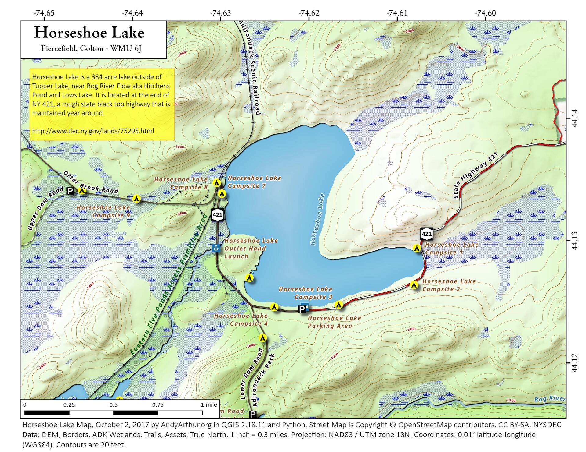
Horseshoe Lake in Franklin County, is located about 15 miles south west of Tupper Lake. There are 6 campsites along the lake, plus 4 others on roads nearby. Near the Hitchens Pond put-in for Lows Lake, a popular spot for camping and paddling.


No Comments
Hi Andy,
The dimensions of each campsite would be very helpful, especially for those with campers. Map looks great compared to other topographic maps I’ve seen, thanks for all your efforts!
Curt
Are there any campgrounds in this area or is it just first come type of deals? I would hate to drive 5 hrs and not be able to get a site. Thx
It is first come first serve, better to choose a weekday as this area is popular.
Hi Andy,
were you able to get cell service anywhere near horseshoe lake? thank you for all you do
There is excellent Verizon cell service at the campsites along Horseshoe Lake especially around sites 7 and 8. I remote worked 3 days during the pandemic in June 2020 from the lake shore. It was delightful!