Deer River Flow
Download a High Resolution JPEG Image of the Deer River Flow or an Adobe Acrobat Printable PDF of the Deer River Flow.


Bookmark my free Interactive GPS Map for your phone:
https://andyarthur.org/ny
... shows your location as a blue dot in relationship to campsites, trails, state land. This online map requires cell service, won't work in remote country, so also bring a paper map.
Free Download of New & Historical USGS 1:24k Topograpic Maps
Interactive maps with backcountry and roadside camping: New York, Pennsylvania, West Virginia & Vermont. List of NYS DEC Lean-Tos and Firetowers.
Google Spreadsheet with Roadside, Primitive and Pay Campsites
More about Deer River Flow...
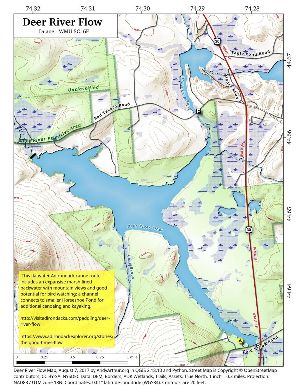
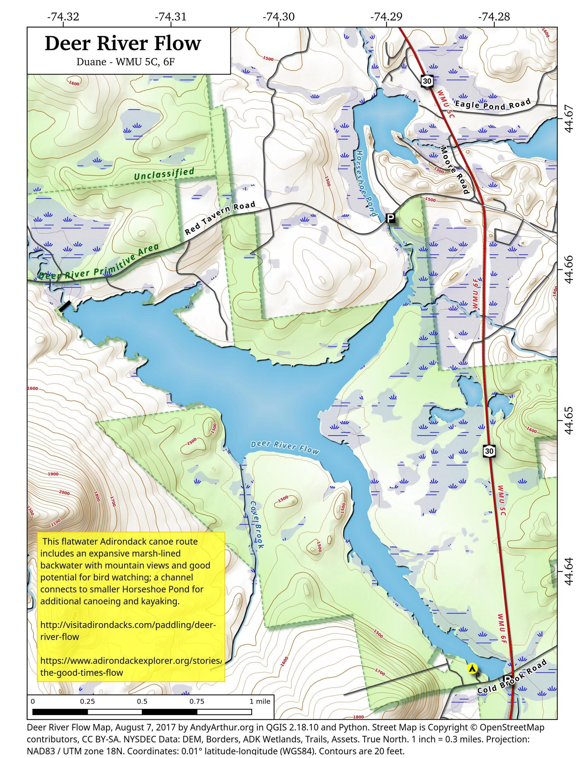
This flatwater Adirondack paddle route includes an expansive marsh-lined backwater with mountain views and good potential for bird watching; a channel connects to smaller Horseshoe Pond for additional canoeing and kayaking.
No Comments
Hi Andy, We found Deer River Flow at Cold Brook Rd and Rt 3. On the south side of Rt 3 traveling North towards Plattsburg we saw a body of water with an island covered in tall conifers. Would you know the name of that water? Also, in the area was small park with sandy beach and a small bridge going over a very small creek. Would you know the name of that park/ campground? I can’t find where we were with four different maps I have looked at . Any help would be appreciated.