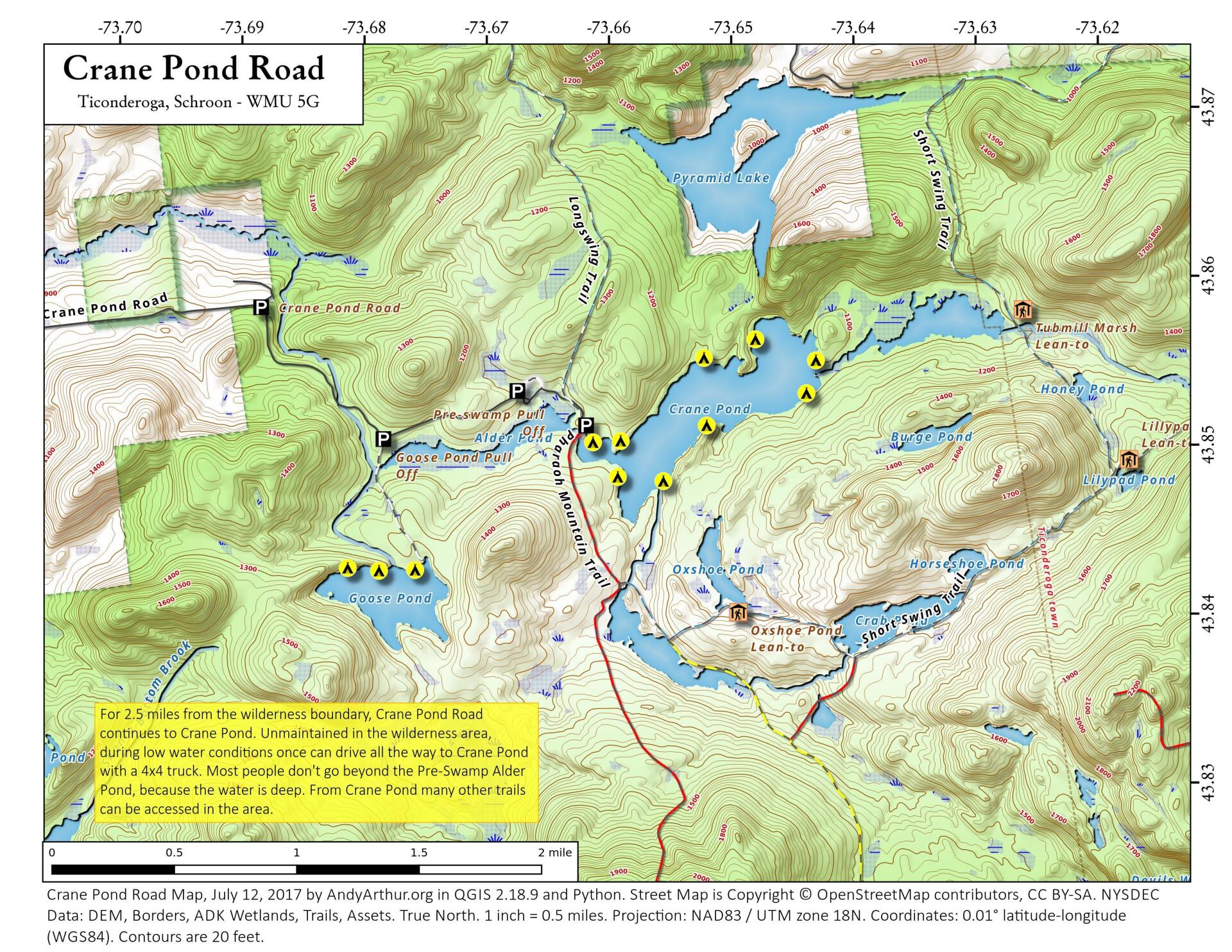
Crane Pond Road
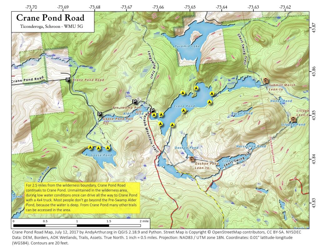
Download a High Resolution JPEG Image of the Crane Pond Road or an Adobe Acrobat Printable PDF of the Crane Pond Road.


Bookmark my free Interactive GPS Map for your phone:
https://andyarthur.org/ny
... shows your location as a blue dot in relationship to campsites, trails, state land. This online map requires cell service, won't work in remote country, so also bring a paper map.
Free Download of New & Historical USGS 1:24k Topograpic Maps
Interactive maps with backcountry and roadside camping: New York, Pennsylvania, West Virginia & Vermont. List of NYS DEC Lean-Tos and Firetowers.
Google Spreadsheet with Roadside, Primitive and Pay Campsites
More about Pharaoh Lake Wilderness...
The Pharaoh Lake Wilderness Area, an Adirondack Park unit of New York's Forest Preserve, straddles the Essex County-Warren County line in the towns of Ticonderoga, Hague, Horicon and Schroon. The county road along the east shore of Schroon Lake forms the western boundary; to the north, private land and NY 74 form the boundary. The state land boundary forms most of the remaining perimeter except for a stretch of NY 8 on the south. The area contains 39 bodies of water covering 1,100 acres (4.4 km2), 62.8 miles (101 km) of foot trails, and 14 lean-tos. Download all maps as a PDF: https://www.scribd.com/document/640711783/Pharaoh-Lake-Wilderness-Map-Pack
Download the PDF Map Pack with All Maps from Pharaoh Lake Wilderness.


