Pillsbury Mountain
Download a High Resolution JPEG Image of the Pillsbury Mountain or an Adobe Acrobat Printable PDF of the Pillsbury Mountain.


Bookmark my free Interactive GPS Map for your phone:
https://andyarthur.org/ny
... shows your location as a blue dot in relationship to campsites, trails, state land. This online map requires cell service, won't work in remote country, so also bring a paper map.
Free Download of New & Historical USGS 1:24k Topograpic Maps
Interactive maps with backcountry and roadside camping: New York, Pennsylvania, West Virginia & Vermont. List of NYS DEC Lean-Tos and Firetowers.
Google Spreadsheet with Roadside, Primitive and Pay Campsites
More about Pillsbury Mountain...
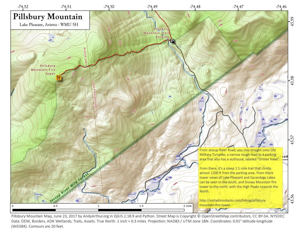
This is a moderate 3.2 mile roundtrip hike to the summit of Pillsbury Mountain with spectacular views from the fire tower. A good choice for those who want to avoid the crowds that are on other popular mountains. At 3597 feet, it’s one of the highest peaks in the Southwest Adirondacks, and the short climb of 1.6 miles ends at a fire tower with a panoramic vista.
One reason Pillsbury doesn’t see as many visitors as other fire-tower peaks is that it lies off the beaten track. To reach the trailhead, you have to drive for about six miles on dirt roads through land owned by Lyme Timber. The last of these roads is a very rough road and some cars park at Sled Harbor and walk the last 1.2 miles to the trailhead. Also, the fire tower has yet to be refurbished, so the enclosed cab remains closed for now. You can still soak up the views from the tower steps.
The hike begins with a short descent to the Miami River, which is just a small stream here. The trail then climbs steadily and sometimes steeply up the mountain. About one mile up, you will enter a spruce-balsam forest similar to that found on the upper slopes of the High Peaks. Soon the grade eases and the final approach is a pleasant stroll. There is a nearly 1500 feet elevation gain on this hike, so it is a moderate hike.


