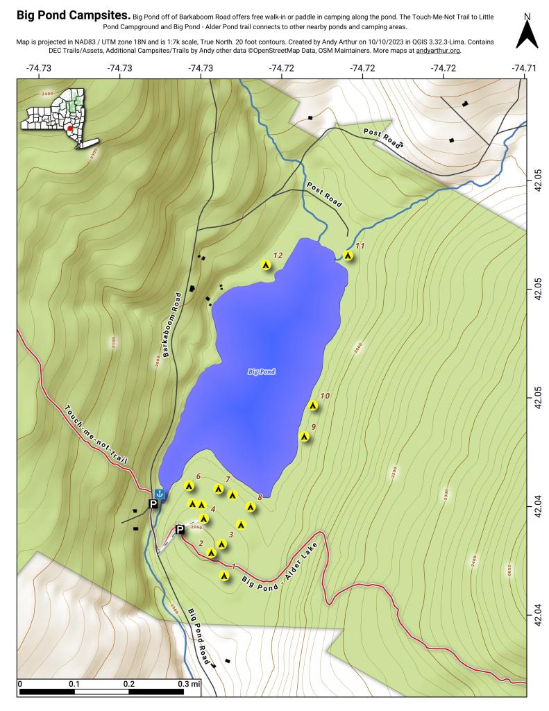
Big Pond
Download a High Resolution JPEG Image of the Big Pond or an Adobe Acrobat Printable PDF of the Big Pond.


Bookmark my free Interactive GPS Map for your phone:
https://andyarthur.org/ny
... shows your location as a blue dot in relationship to campsites, trails, state land. This online map requires cell service, won't work in remote country, so also bring a paper map.
Free Download of New & Historical USGS 1:24k Topograpic Maps
Interactive maps with backcountry and roadside camping: New York, Pennsylvania, West Virginia & Vermont. List of NYS DEC Lean-Tos and Firetowers.
Google Spreadsheet with Roadside, Primitive and Pay Campsites
More about Big Pond...
At 50‐acre Big Pond, non‐motorized boats can be launched from the small parking lot. Several unmarked trails andmeadows connect a larger parking lot a few hundred feet to the south oft he lake. Big Pond is about one‐half mile north of the entrance road to Little Pond Campground on Barkaboom Road.
Download the PDF Map Pack with All Maps from Big Pond.


