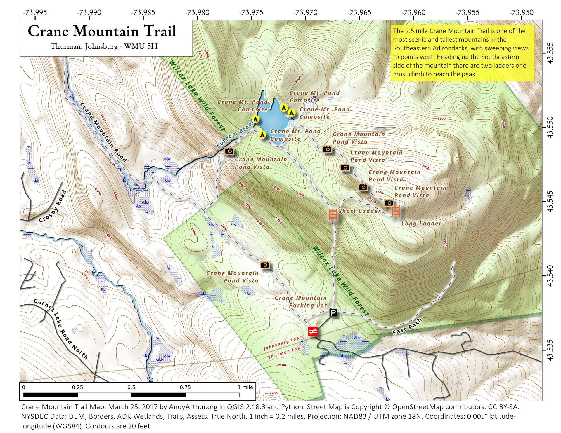
Crane Mountain Trail

Download a High Resolution JPEG Image of the Crane Mountain Trail or an Adobe Acrobat Printable PDF of the Crane Mountain Trail.


Bookmark my free Interactive GPS Map for your phone:
https://andyarthur.org/ny
... shows your location as a blue dot in relationship to campsites, trails, state land. This online map requires cell service, won't work in remote country, so also bring a paper map.
Free Download of New & Historical USGS 1:24k Topograpic Maps
Interactive maps with backcountry and roadside camping: New York, Pennsylvania, West Virginia & Vermont. List of NYS DEC Lean-Tos and Firetowers.
Google Spreadsheet with Roadside, Primitive and Pay Campsites
More about Crane Mountain...
Crane Mountain is in the Central Adirondacks in Wilcox Lake Wild Forest near Wevertown in Warren County. There are over five miles of marked hiking trails on the 3254 foot mountain. There are many spectacular views from the open areas on the mountain, making this a very popular hike. There is an elevation gain of over 1300 feet. There are very steep sections on this short hike, but this tough hike is worth the view.
http://www.cnyhiking.com/CraneMountain.htm
http://www.adirondack.net/business/crane-mountain-11204/


