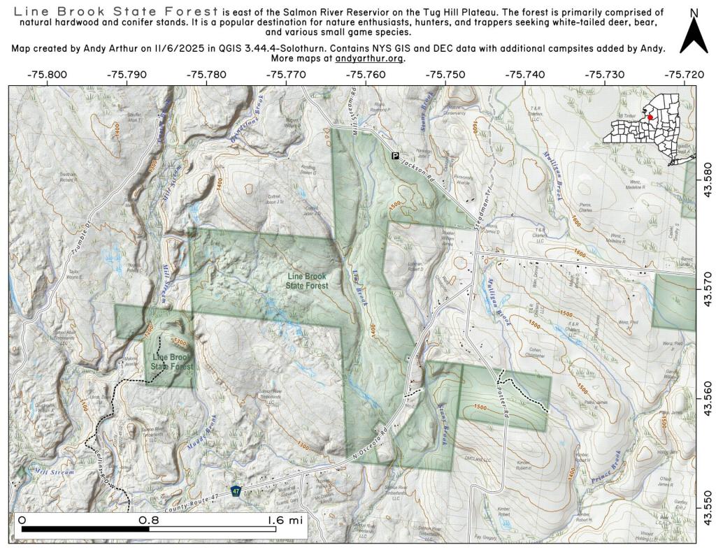
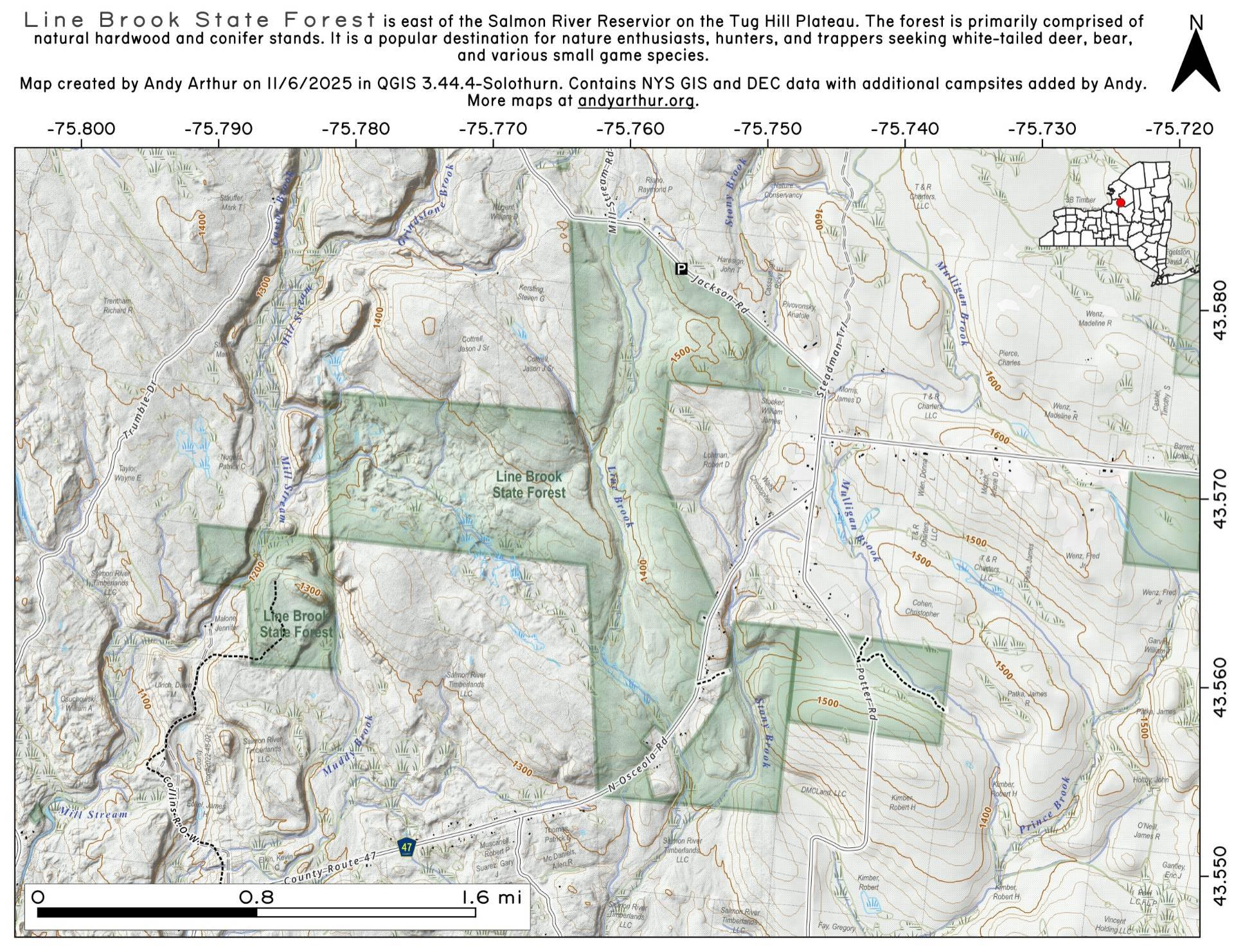
Line Brook State Forest
Download a High Resolution JPEG Image of the Line Brook State Forest or an Adobe Acrobat Printable PDF of the Line Brook State Forest.


Bookmark my free Interactive GPS Map for your phone:
https://andyarthur.org/ny
... shows your location as a blue dot in relationship to campsites, trails, state land. This online map requires cell service, won't work in remote country, so also bring a paper map.
Free Download of New & Historical USGS 1:24k Topograpic Maps
Interactive maps with backcountry and roadside camping: New York, Pennsylvania, West Virginia & Vermont. List of NYS DEC Lean-Tos and Firetowers.
Google Spreadsheet with Roadside, Primitive and Pay Campsites
More about Lewis County...
Lewis County is a county located in the U.S. state of New York. As of the 2010 census, the population was 27,087.[1] It is named after Morgan Lewis, the Governor of New York when the county was established. Its county seat is Lowville.
Lewis County is located in northwestern New York State, slightly east of due north from Syracuse. The eastern part of the county is in the Adirondack Park. A good portion of the Tug Hill Plateau is in the western part of the county. The county is home to the Black River Valley.
http://en.wikipedia.org/wiki/Lewis_County,_New_York
Download the PDF Map Pack with All Maps from Lewis County.


")