Spruce Creek State Forest
Download a High Resolution JPEG Image of the Spruce Creek State Forest or an Adobe Acrobat Printable PDF of the Spruce Creek State Forest.


Bookmark my free Interactive GPS Map for your phone:
https://andyarthur.org/ny
... shows your location as a blue dot in relationship to campsites, trails, state land. This online map requires cell service, won't work in remote country, so also bring a paper map.
Free Download of New & Historical USGS 1:24k Topograpic Maps
Interactive maps with backcountry and roadside camping: New York, Pennsylvania, West Virginia & Vermont. List of NYS DEC Lean-Tos and Firetowers.
Google Spreadsheet with Roadside, Primitive and Pay Campsites
More about Spruce Creek State Forest...
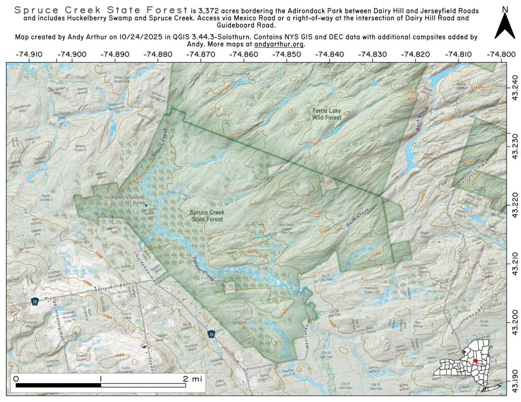
Spruce Creek State Forest is 3,372 acres bordering the Adirondack Park between Dairy Hill and Jerseyfield Roads and includes Huckelberry Swamp and Spruce Creek. Access via Mexico Road or a right-of-way at the intersection of Dairy Hill Road and Guideboard Road.