Day: July 30, 2025💾

🗺️ Maps 🖼️ Photos
Terrain Map: Peebles Island 1952

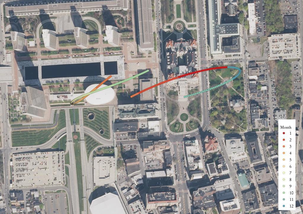
Corning Tower Shadow

This shows an analysis of the maximum point of shadow at 2 PM from the Corning Tower in Downtown Albany. As one might guess, the shadow is much shorter in the summer due to the higher elevation of the sun. There are two separate sun paths, reflecting the later hour during daylight savings time in the summer.

Ortho Corning Tower

Terrain Map: Peebles Island Terrian
Map: Empire State Topography

State Route 414 in Pennsylvania

Wild and wonderful Pennsylvania. Not a recommended route though if you are in a hurry, as this road is very slow and twisty, but also scenic too.

Map: Leonard Hill State Forest
Map: Big Eddy Trail