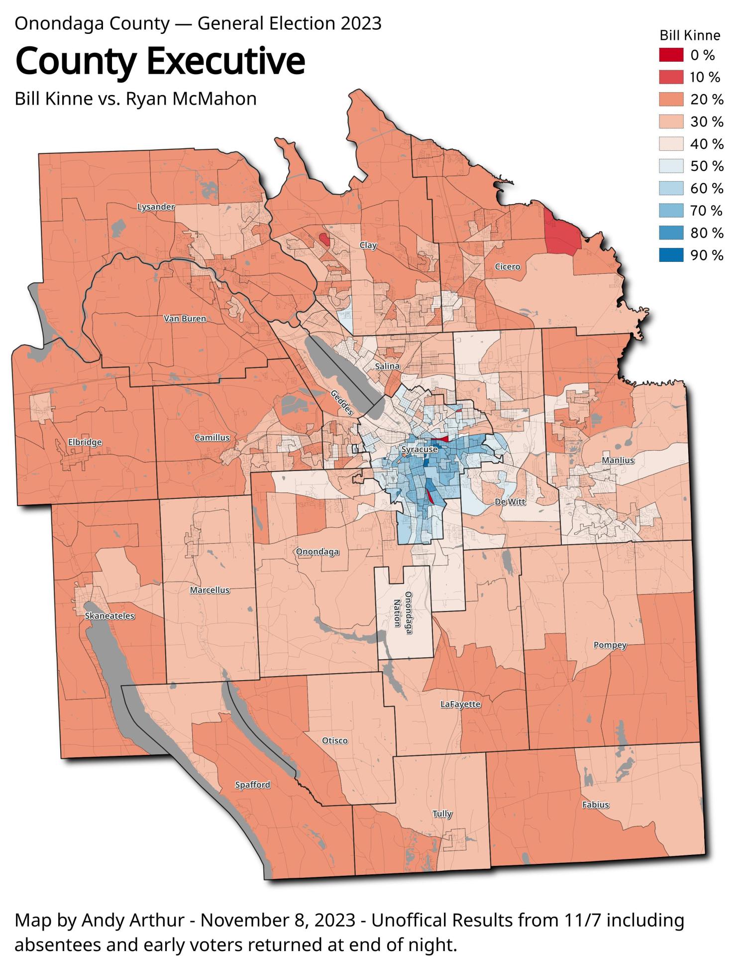
Onondoga County Executive 2023 – Bill Kinne vs. Ryan McMahon 🗺️

Download a High Resolution JPEG Image of the Onondoga County Executive 2023 - Bill Kinne vs. Ryan McMahon or an Adobe Acrobat Printable PDF of the Thematic Onondoga County Executive 2023 - Bill Kinne vs. Ryan McMahon.
")
More about Onondaga County...
Onondaga County (/ˈɒnənˈdɑːɡə/ on-ən-dah-gə) is a county located in the U.S. state of New York. As of the 2010 census, the population was 467,026.[1] The county seat is Syracuse.
Onondaga County is part of the Syracuse, NY Metropolitan Statistical Area.
http://en.wikipedia.org/wiki/Onondaga_County,_New_York


