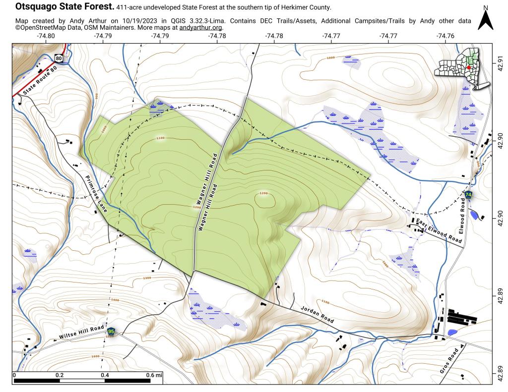
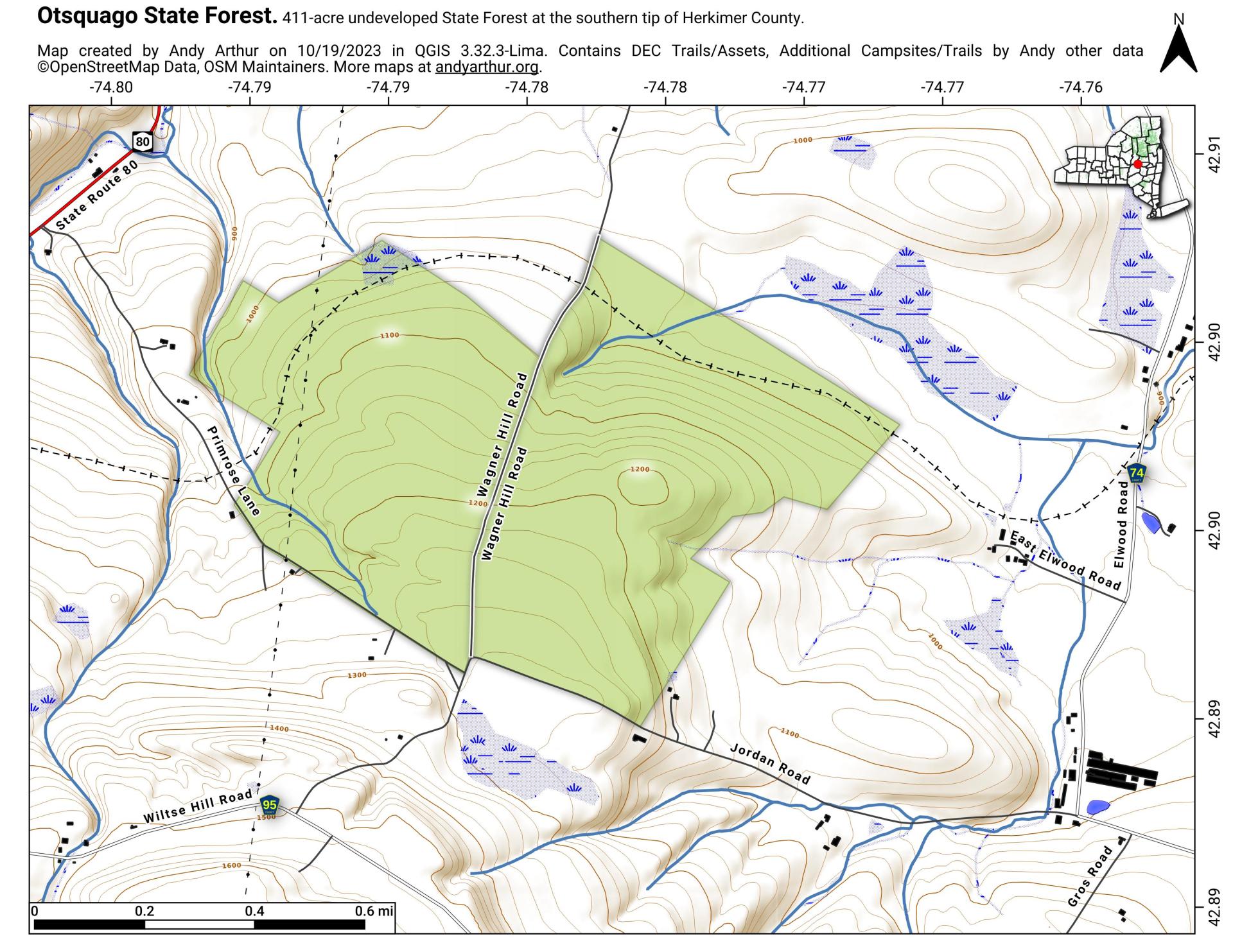
Otsquago State Forest
Download a High Resolution JPEG Image of the Otsquago State Forest or an Adobe Acrobat Printable PDF of the Otsquago State Forest.


Bookmark my free Interactive GPS Map for your phone:
https://andyarthur.org/ny
... shows your location as a blue dot in relationship to campsites, trails, state land. This online map requires cell service, won't work in remote country, so also bring a paper map.
Free Download of New & Historical USGS 1:24k Topograpic Maps
Interactive maps with backcountry and roadside camping: New York, Pennsylvania, West Virginia & Vermont. List of NYS DEC Lean-Tos and Firetowers.
Google Spreadsheet with Roadside, Primitive and Pay Campsites
More about Herkimer County...
Herkimer County is a county located in the U.S. state of New York. It was created in 1791 north of the Mohawk River out of part of Montgomery County. As of the 2010 census, the population was 64,519
Herkimer County is in central New York State, northwest of Albany, and east of Syracuse. The northern part of the county is in the Adirondack Park. The Mohawk River flows across the south part of the county.
http://en.wikipedia.org/wiki/Herkimer_County,_New_York


