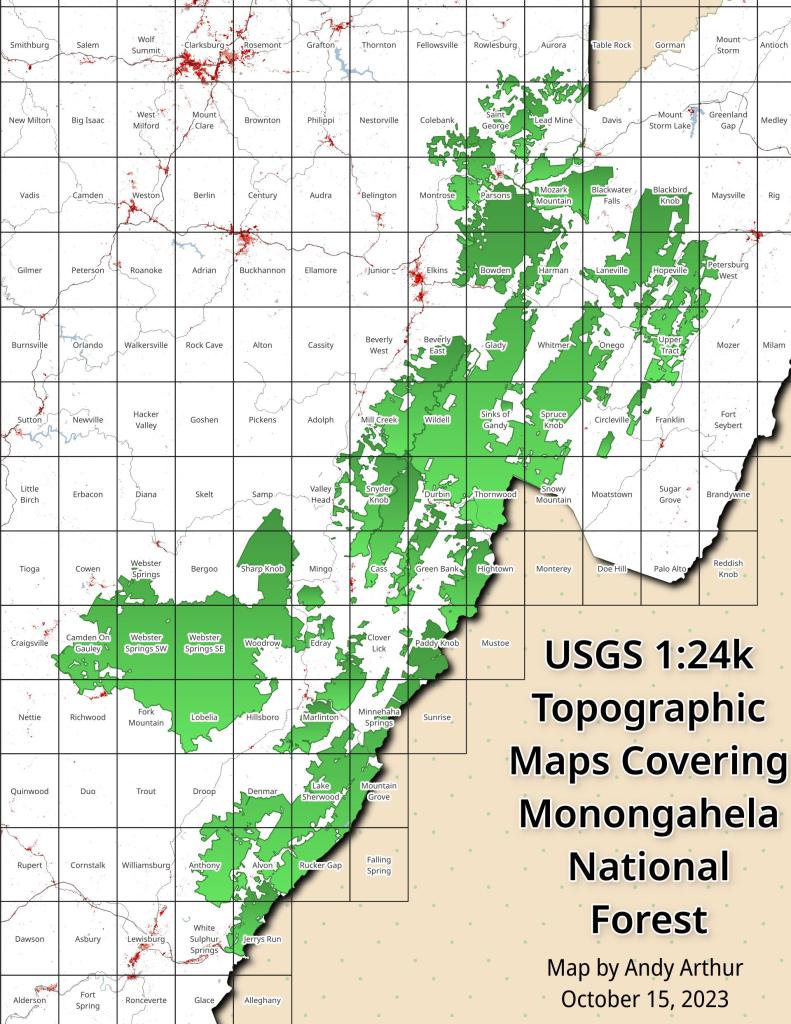
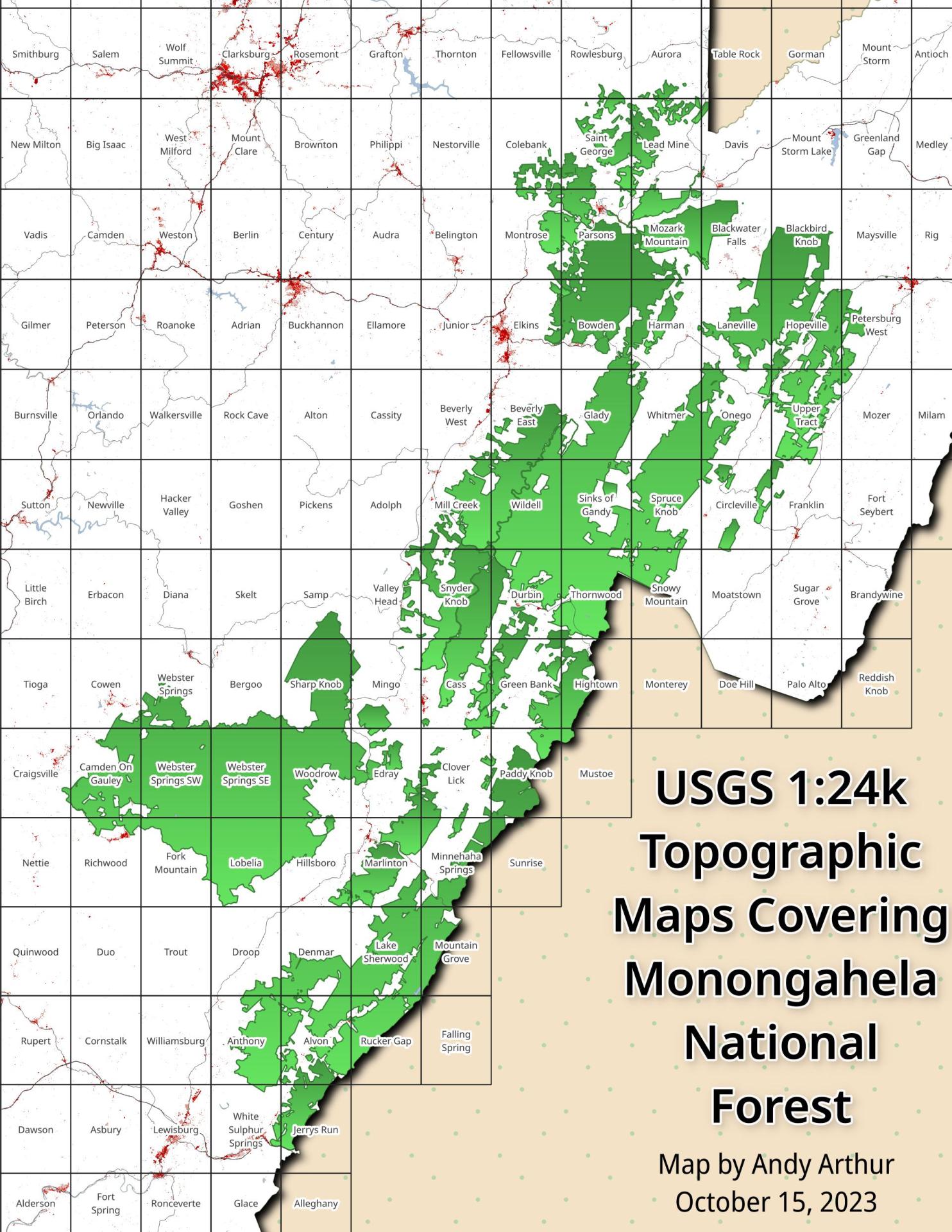
Monongahela National Forest 1:24k Topographic Map Index
Download a High Resolution JPEG Image of the Monongahela National Forest 1:24k Topographic Map Index or an Adobe Acrobat Printable PDF of the Monongahela National Forest 1:24k Topographic Map Index.
About Map: Monongahela National Forest 1:24k Topographic Map Index ....
This index map shows all of the USGS Topographic Maps that cover the Monongahela National Forest.
You can get these topographic maps for free here.


Bookmark my free Interactive GPS Map for your phone:
https://andyarthur.org/ny
... shows your location as a blue dot in relationship to campsites, trails, state land. This online map requires cell service, won't work in remote country, so also bring a paper map.
Free Download of New & Historical USGS 1:24k Topograpic Maps
Interactive maps with backcountry and roadside camping: New York, Pennsylvania, West Virginia & Vermont. List of NYS DEC Lean-Tos and Firetowers.
Google Spreadsheet with Roadside, Primitive and Pay Campsites
More about Monongahela National Forest...
Spanning the Appalachian Mountains of West Virginia, Monongahela National Forest sprawls across 900,000 acres of diverse landscapes. Its lush forests, rolling hills, and rugged mountains create a haven for outdoor enthusiasts. With abundant trails, including those in the designated Cranberry Wilderness, hiking, camping, fishing, and wildlife watching are popular pursuits. The forest offers primitive and roadside camping, allowing visitors to immerse themselves in nature. While embracing its wilderness charm, it's important to note that limited cell service adds to the authentic back-to-nature experience. From the Allegheny Plateau to mountainous terrains, Monongahela National Forest beckons adventurers to explore its untouched beauty and embrace the outdoor splendor of the Appalachian region.
https://www.fs.usda.gov/mnf
https://en.wikipedia.org/wiki/Monongahela_National_Forest
Download the PDF Map Pack with All Maps from Monongahela National Forest.


