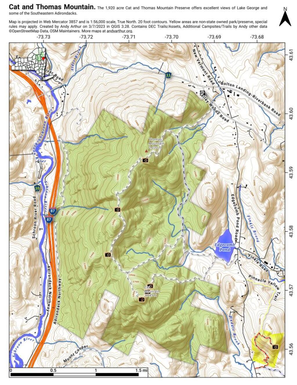
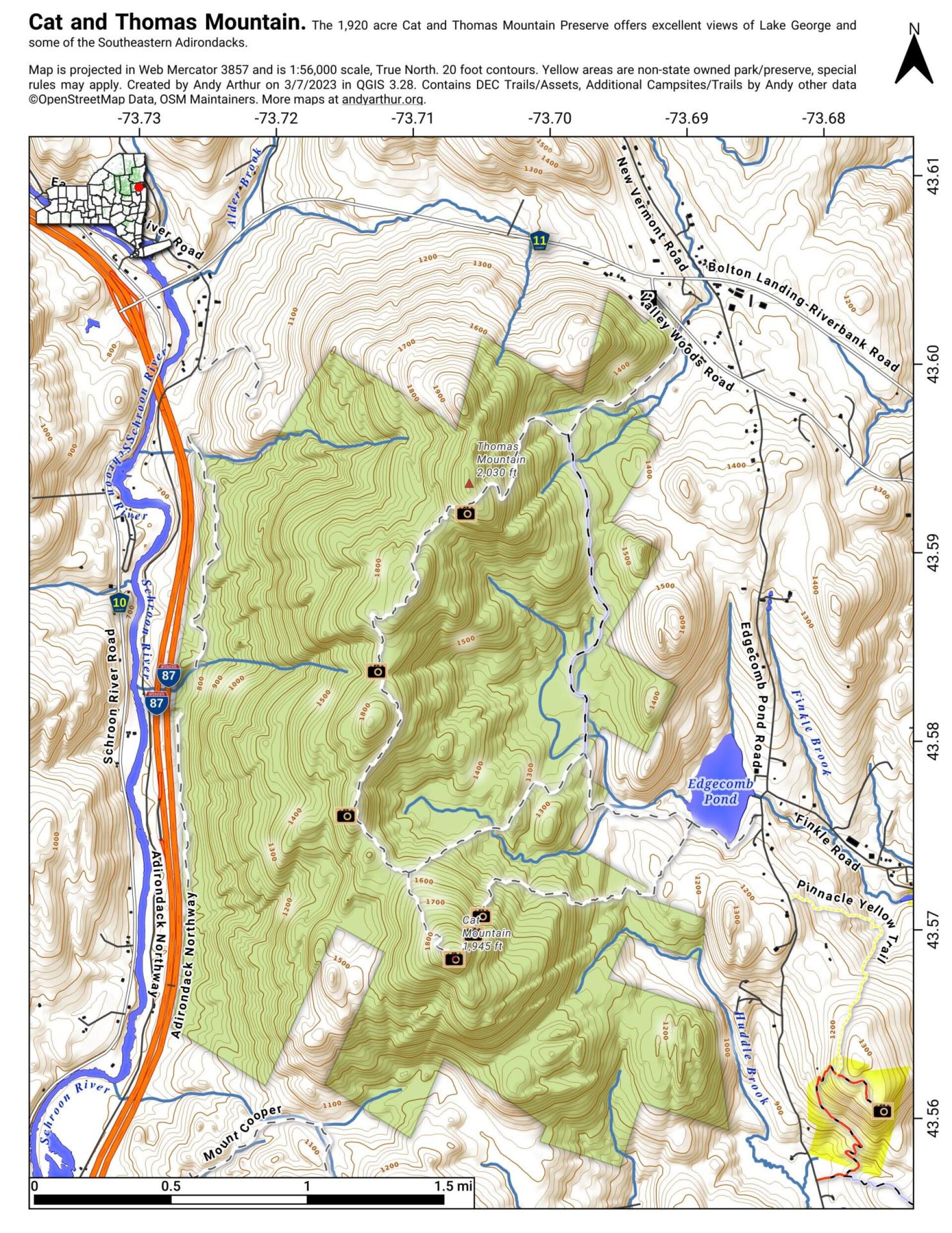
Cat and Thomas Mountain
Download a High Resolution JPEG Image of the Cat and Thomas Mountain or an Adobe Acrobat Printable PDF of the Cat and Thomas Mountain.


Bookmark my free Interactive GPS Map for your phone:
https://andyarthur.org/ny
... shows your location as a blue dot in relationship to campsites, trails, state land. This online map requires cell service, won't work in remote country, so also bring a paper map.
Free Download of New & Historical USGS 1:24k Topograpic Maps
Interactive maps with backcountry and roadside camping: New York, Pennsylvania, West Virginia & Vermont. List of NYS DEC Lean-Tos and Firetowers.
Google Spreadsheet with Roadside, Primitive and Pay Campsites
More about Cat & Thomas Mountains Preserve...
This 1,909-acre parcel was acquired by the Lake George Land Conservancy (LGLC) in 2003 and sold to the state in 2013. It is now part of the Adirondack Forest Preserve. Its preservation is a major accomplishment in protecting the Lake George watershed, as one of the lake’s larger tributaries, Finkle Brook, flows through the preserve and forms Edgecomb Pond, the drinking water source for Bolton Landing.
http://www.lglc.org/preserves/cat-thomas-mountains/


