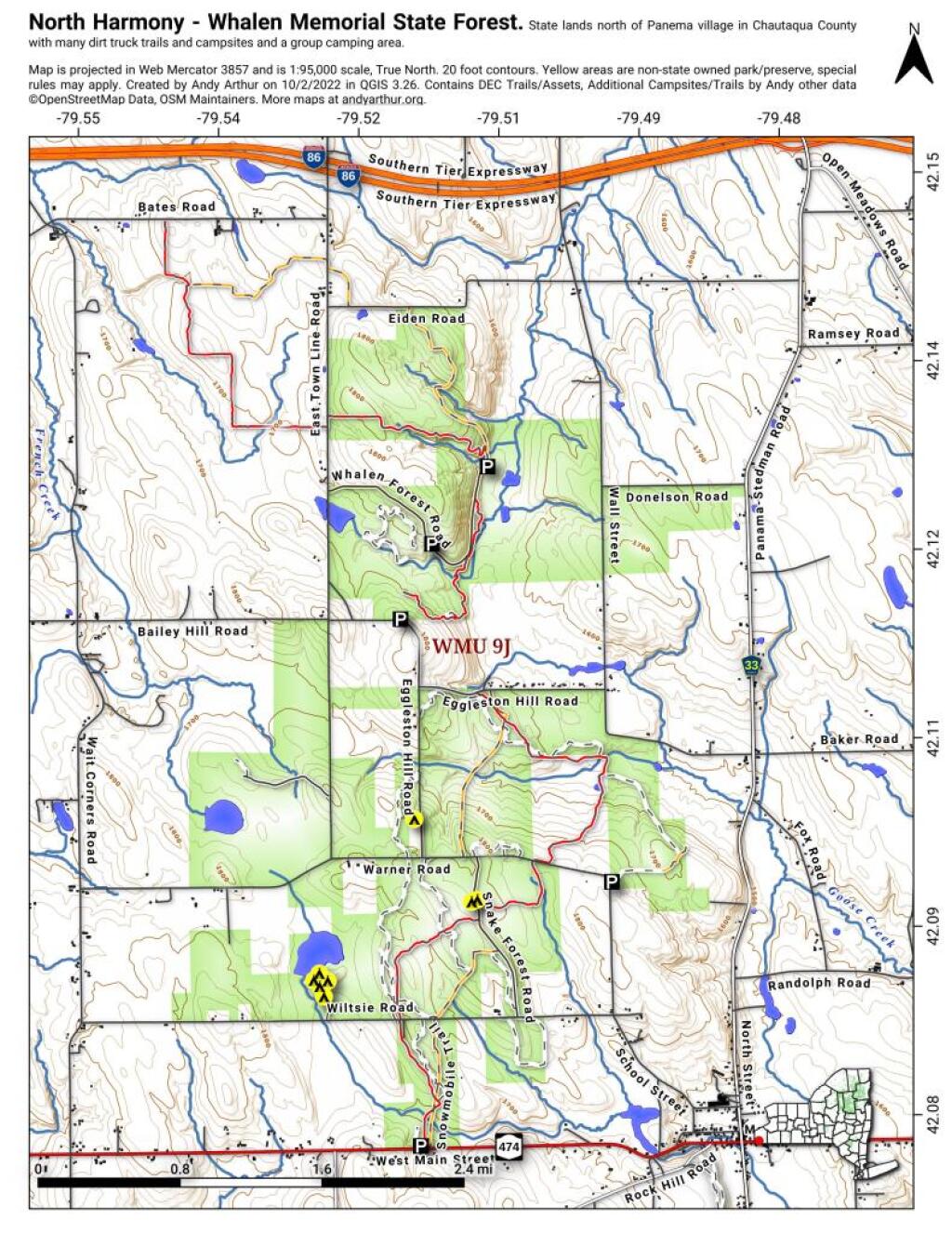
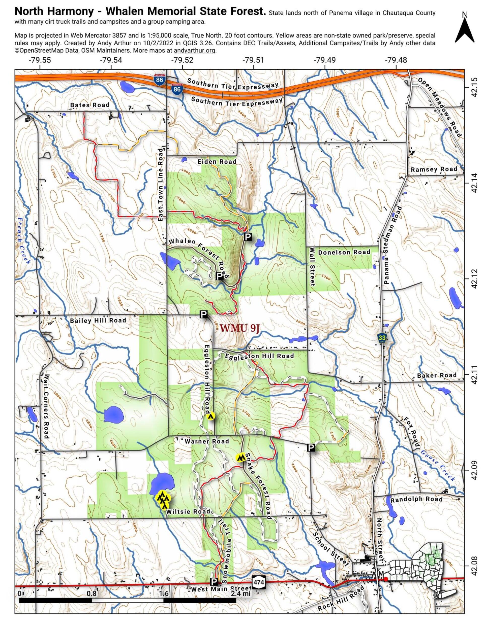
North Harmony – Whalen Memorial State Forest
Download a High Resolution JPEG Image of the North Harmony - Whalen Memorial State Forest or an Adobe Acrobat Printable PDF of the North Harmony - Whalen Memorial State Forest.


Bookmark my free Interactive GPS Map for your phone:
https://andyarthur.org/ny
... shows your location as a blue dot in relationship to campsites, trails, state land. This online map requires cell service, won't work in remote country, so also bring a paper map.
Free Download of New & Historical USGS 1:24k Topograpic Maps
Interactive maps with backcountry and roadside camping: New York, Pennsylvania, West Virginia & Vermont. List of NYS DEC Lean-Tos and Firetowers.
Google Spreadsheet with Roadside, Primitive and Pay Campsites
More about North Harmony State Forest...
North Harmony State Forest (Chautauqua #2) totals 2,561 acres and is located in the southwestern area of Chautauqua County in the Towns of Harmony, North Harmony and Sherman, north of Panama. North Harmony State Forest provides many outdoor recreational opportunities such as cross-country skiing, snowshoeing, hiking and hunting. It also serves as a source of raw material for New York's forest products industry which provides employment and income for many New Yorkers and provides for various habitats for many wildlife species such as deer, rabbit, grouse and turkey.
http://www.dec.ny.gov/lands/8268.html


