North Lake Reservoir Camping 🏕
North Lake Reservoir Camping 🏕
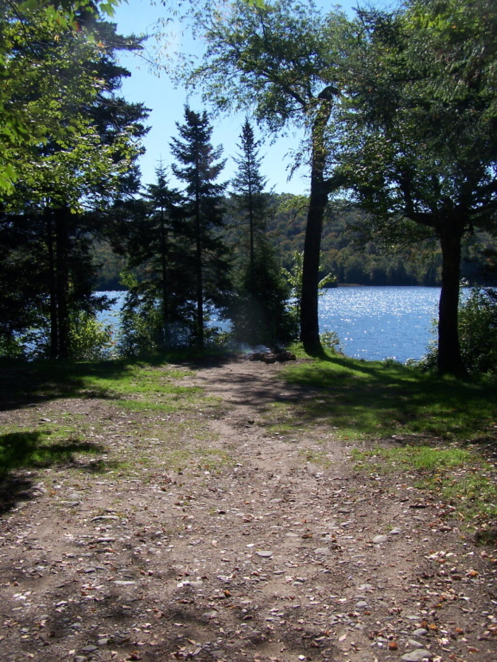
16 1/2 miles and 30 miles north of Forestport, the North Lake Reservoir serves as the headwaters to the Black River in a large reservoir maintained by the NYS Canal Authority for supplying a steady supply of water to Black River and Erie Canal via the former Black River Canal. Half of sites are on Black River Wild Forest, while most of the northernly sites are on a conservation easement. There is a sign-on booth for these campsites, permits are needed for stays over three nights. These are primitive campsites, though some of the sites along the eastern side, are accessible by a vehicle with a smaller camper on top. Boats with motors are allowed on this lake, so in summer months it may be not a quiet water. Most sites are on the water.
Interactive Map of North Lake Reservoir
Printable Map of North Lake Reservoir
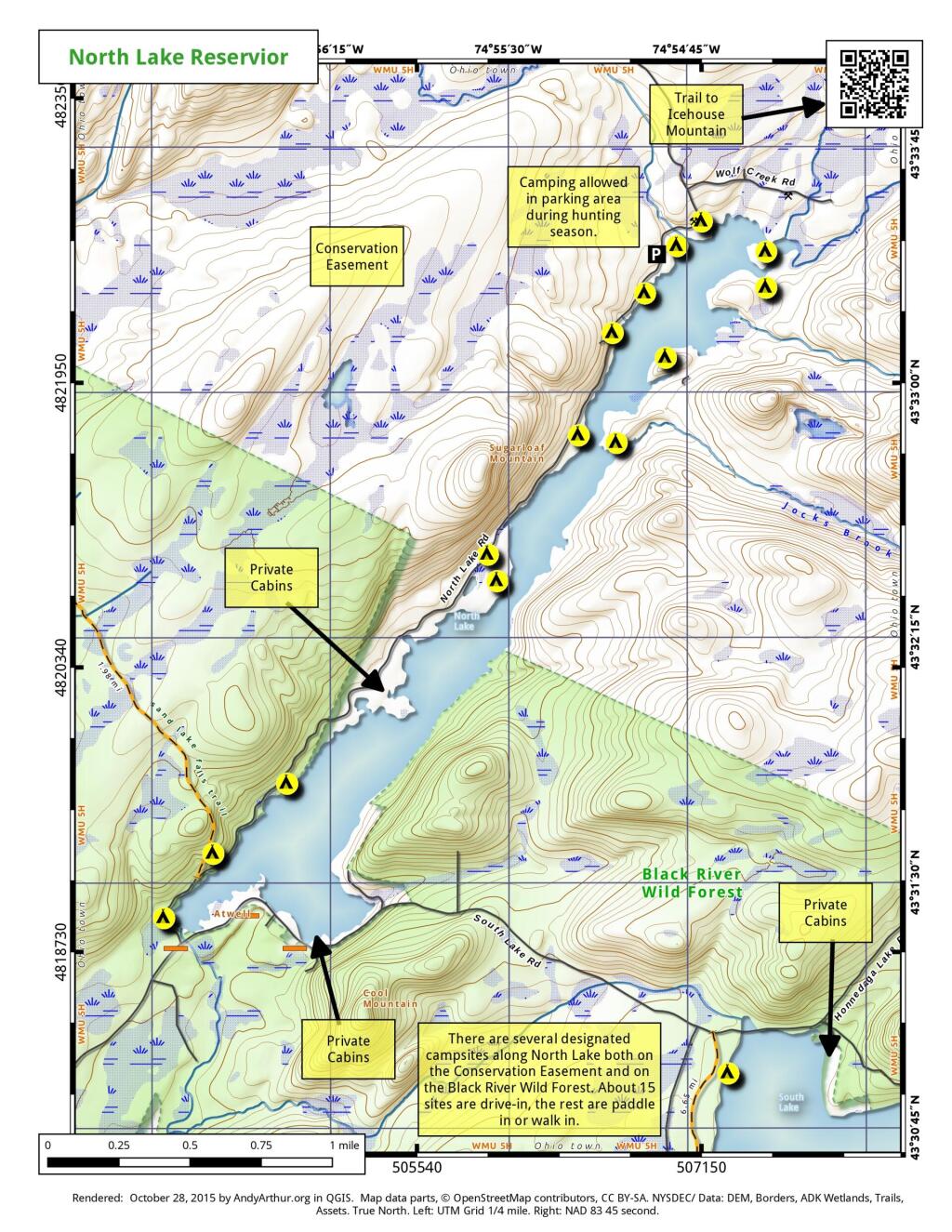
Coordinates of North Lake Reservoir Campsites
Easement campsites are based on memory and were hand-drawn so they may be somewhat inaccurate.
| Name | Latitude | Longitude |
| North Lake Designated Campsite #2 | 43.52293019 | -74.94933889 |
| North Lake Designated Campsite #3 | 43.52335381 | -74.94934207 |
| North Lake Designated Campsite #4 | 43.52506095 | -74.94695943 |
| North Lake Designated Campsite #6 | 43.52569387 | -74.94579628 |
| North Lake Designated Campsite #7 | 43.52600551 | -74.94534407 |
| North Lake Designated Campsite #8 | 43.52775406 | -74.94410338 |
| North Lake Designated Campsite #9 | 43.52800073 | -74.94327684 |
| North Lake Designated Campsite #10 | 43.52898888 | -74.94247143 |
| North Lake Designated Campsite #11 | 43.52977988 | -74.9403576 |
| Easement Campsite | 43.61254681 | -75.05263918 |
| Easement Campsite | 43.51529059 | -74.90967 |
| Easement Campsite | 43.48088879 | -75.01092893 |
| Easement Campsite | 43.54038222 | -74.92580987 |
| Easement Campsite | 43.61805247 | -75.03272826 |
| Easement Campsite | 43.61368033 | -75.09087559 |
| Easement Campsite | 43.61053007 | -75.02701572 |
| Easement Campsite | 43.58885404 | -74.999126 |
| Easement Campsite | 43.59254977 | -75.0887635 |
| Easement Campsite | 43.59171534 | -75.00692959 |