Canastota Gorge
Download a High Resolution JPEG Image of the Canastota Gorge or an Adobe Acrobat Printable PDF of the Canastota Gorge.
About Map: Canastota Gorge ....
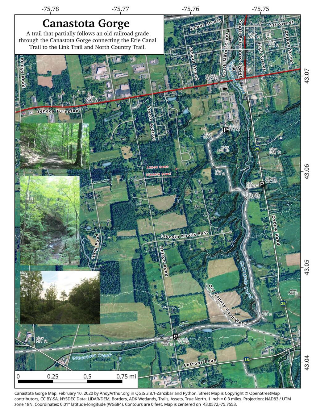
State lands along the North Country / Link Trail that run from Canastota towards Cazenovia, along an old rail-bed. On this trail you will explore a fairly deep gorge where the Canastota Creek runs, and walk past the old Canastota Reservoir. Most of the trail runs along an old railroad bed, providing a nice leisurely stroll, with views of the gorge below.


Bookmark my free Interactive GPS Map for your phone:
https://andyarthur.org/ny
... shows your location as a blue dot in relationship to campsites, trails, state land. This online map requires cell service, won't work in remote country, so also bring a paper map.
Free Download of New & Historical USGS 1:24k Topograpic Maps
Interactive maps with backcountry and roadside camping: New York, Pennsylvania, West Virginia & Vermont. List of NYS DEC Lean-Tos and Firetowers.
Google Spreadsheet with Roadside, Primitive and Pay Campsites
More about Canastota-Cazenovia State Trailway...
State lands along the North Country / Link Trail that run from Canastota towards Cazenovia, along an old railbed. On this trail you will explore a fairly deep gorge where the Canastota Creek runs, and walk past the old Canastota Reservoir. Most of the trail runs along an old railroad bed, providing a nice leisurely stroll, with views of the gorge below.


No Comments
The jars are oil containers from pre WW11
I found some on a link trail above Chittenango Falls and researched them
The company eventually became Penns Oil