Big Flats Wildlife Management Area
Download a High Resolution JPEG Image of the Big Flats Wildlife Management Area or an Adobe Acrobat Printable PDF of the Big Flats Wildlife Management Area.
About Map: Big Flats Wildlife Management Area ....
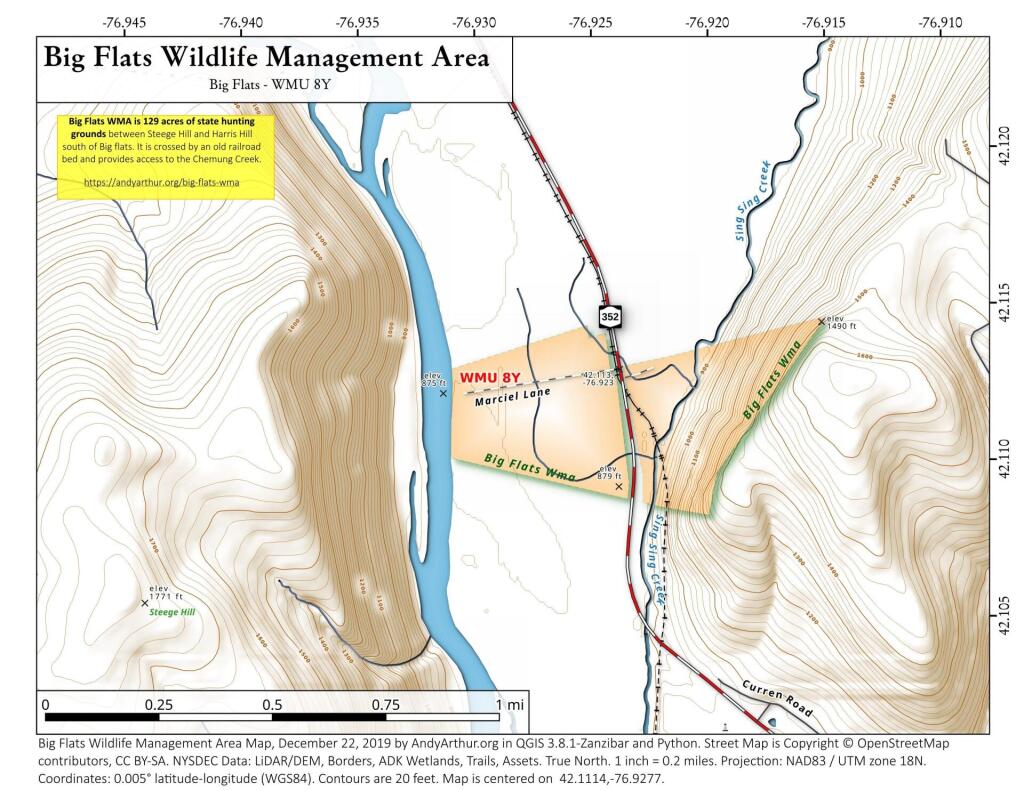
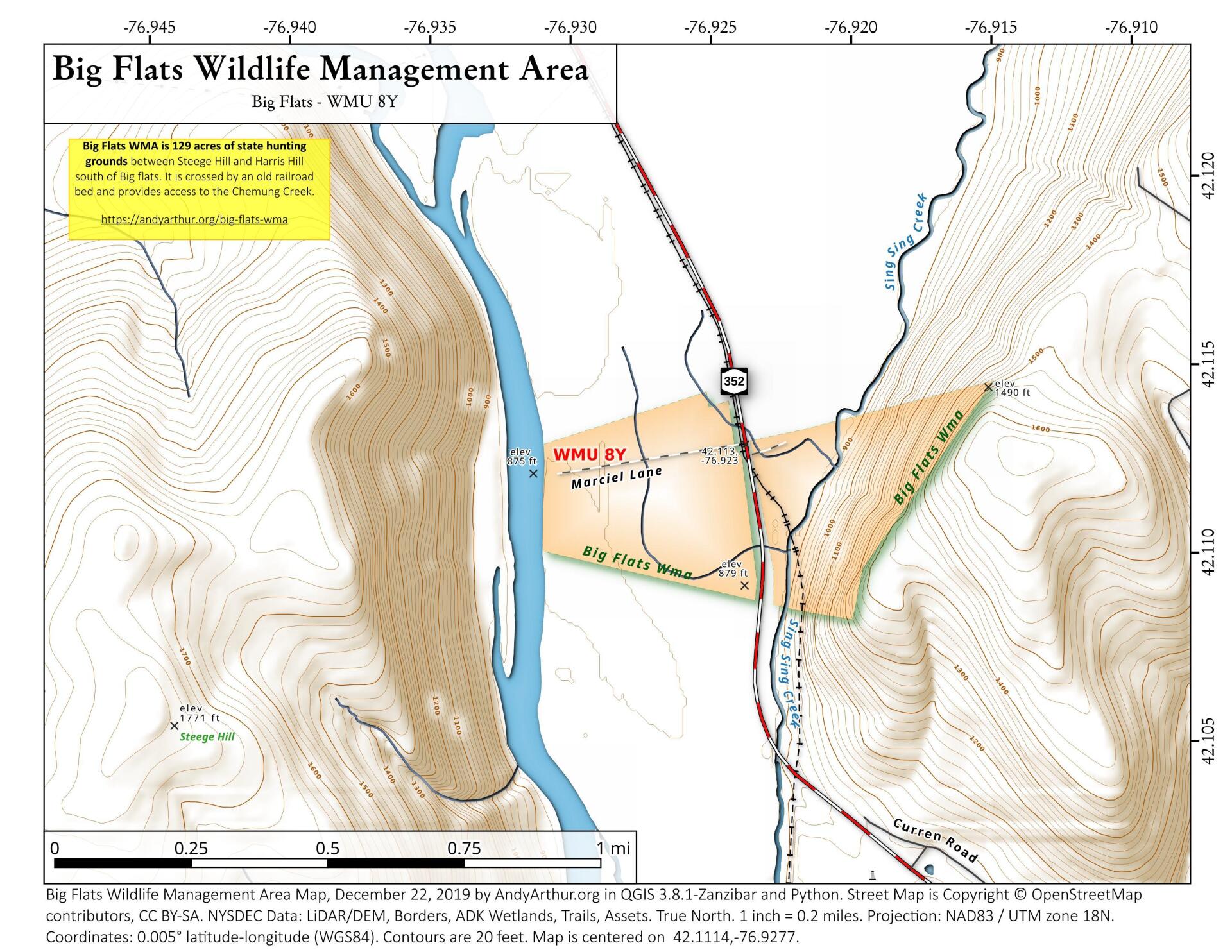
Big Flats WMA is 129 acres of state hunting grounds between Steege Hill and Harris Hill, commonly known as the "Palasades" of Chenango County, south of Big Flats. This narrow, agricultural valley is famous for it's wildlife and raptors, including bald eagles. Additional parcels will be added to the preserve in coming years. https://www.stargazette.com/story/news/local/2019/06/10/big-flats-natural-landmark-protected-finger-lakes-land-trust-chemung-river/1407352001/


Bookmark my free Interactive GPS Map for your phone:
https://andyarthur.org/ny
... shows your location as a blue dot in relationship to campsites, trails, state land. This online map requires cell service, won't work in remote country, so also bring a paper map.
Free Download of New & Historical USGS 1:24k Topograpic Maps
Interactive maps with backcountry and roadside camping: New York, Pennsylvania, West Virginia & Vermont. List of NYS DEC Lean-Tos and Firetowers.
Google Spreadsheet with Roadside, Primitive and Pay Campsites
More about Chemung County, NY...
Chemung County is a county located in the U.S. state of New York. It is part of the 'Elmira, New York Metropolitan Statistical Area' which encompasses all of Chemung County. Its county seat is Elmira.
Chemung County is in the southwestern part of New York State, along the Pennsylvania border, in a part of New York called the Southern Tier and is also part of the Finger Lakes Region. According to the U.S. Census Bureau, the county has a total area of 411 square miles (1,064.5 km2), of which 408 square miles (1,056.7 km2) is land and 3 square miles (7.8 km2) (0.64%) is water.
The Southern Tier Expressway runs through the County east-west near the Pennsylvania border, between Waverly, New York and Corning, New York via Elmira, New York.