Big Bay Of Piseco Lake

Download a High Resolution JPEG Image of the Big Bay Of Piseco Lake or an Adobe Acrobat Printable PDF of the Big Bay Of Piseco Lake.
About Map: Big Bay Of Piseco Lake ....
43.39056819528941,-74.56076401185811
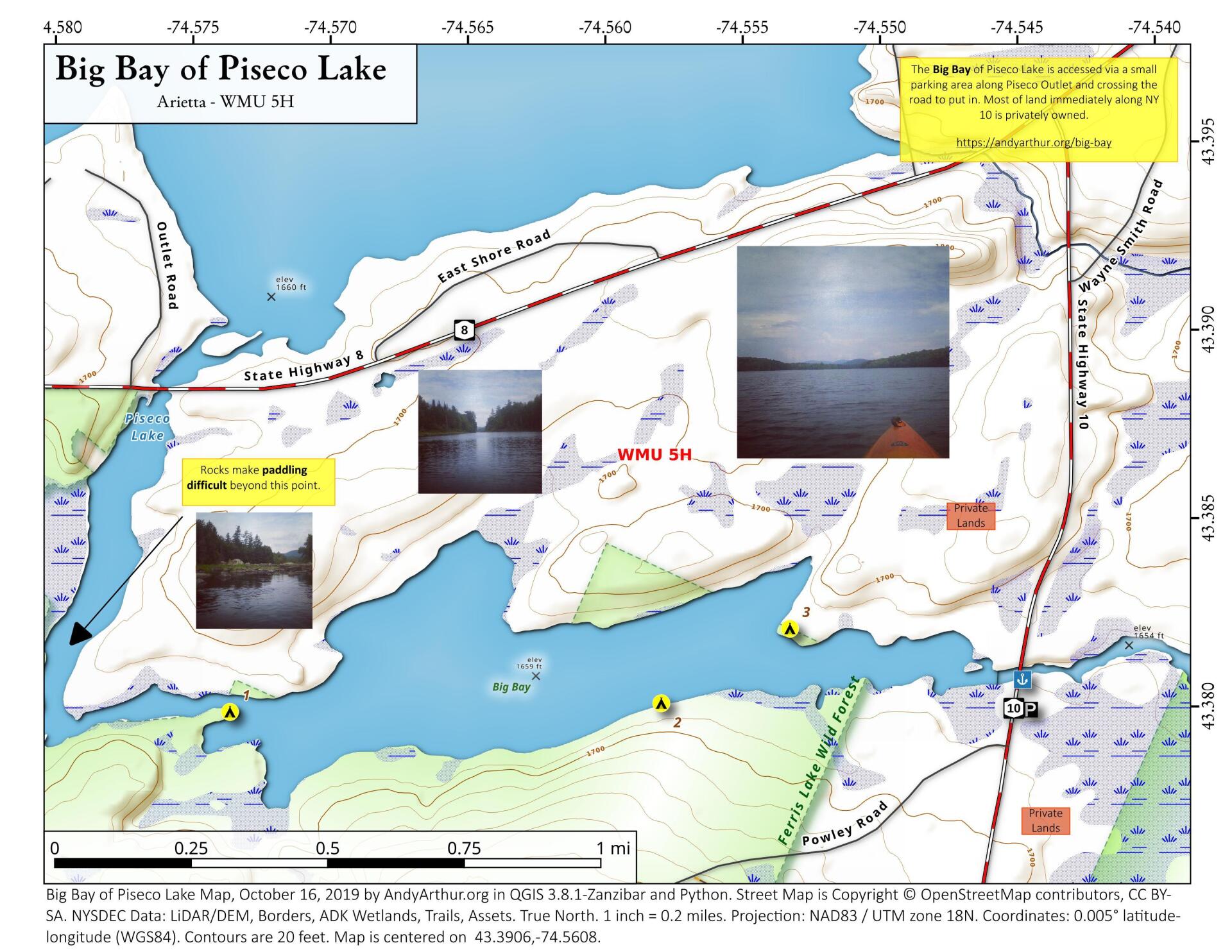
The Big Bay of Piseco Lake is accessed via a small parking area along Piseco Outlet and crossing the road to put in. Most of land immediately along NY 10 is privately owned.
https://andyarthur.org/big-bay


Bookmark my free Interactive GPS Map for your phone:
https://andyarthur.org/ny
... shows your location as a blue dot in relationship to campsites, trails, state land. This online map requires cell service, won't work in remote country, so also bring a paper map.
Free Download of New & Historical USGS 1:24k Topograpic Maps
Interactive maps with backcountry and roadside camping: New York, Pennsylvania, West Virginia & Vermont. List of NYS DEC Lean-Tos and Firetowers.
Google Spreadsheet with Roadside, Primitive and Pay Campsites
More about Big Bay of Piseco Lake...
Big Bay of Piseco Lake is a dammed up section of the West Branch of the Sacandaga River, just south of Piseco Lake. There is a small parking area off of NY 10, where you can put in a kayak and paddle around Big Bay. There also are several campsites along Big Bay.


