Slush Pond Road
Download a High Resolution JPEG Image of the Slush Pond Road or an Adobe Acrobat Printable PDF of the Slush Pond Road.


Bookmark my free Interactive GPS Map for your phone:
https://andyarthur.org/ny
... shows your location as a blue dot in relationship to campsites, trails, state land. This online map requires cell service, won't work in remote country, so also bring a paper map.
Free Download of New & Historical USGS 1:24k Topograpic Maps
Interactive maps with backcountry and roadside camping: New York, Pennsylvania, West Virginia & Vermont. List of NYS DEC Lean-Tos and Firetowers.
Google Spreadsheet with Roadside, Primitive and Pay Campsites
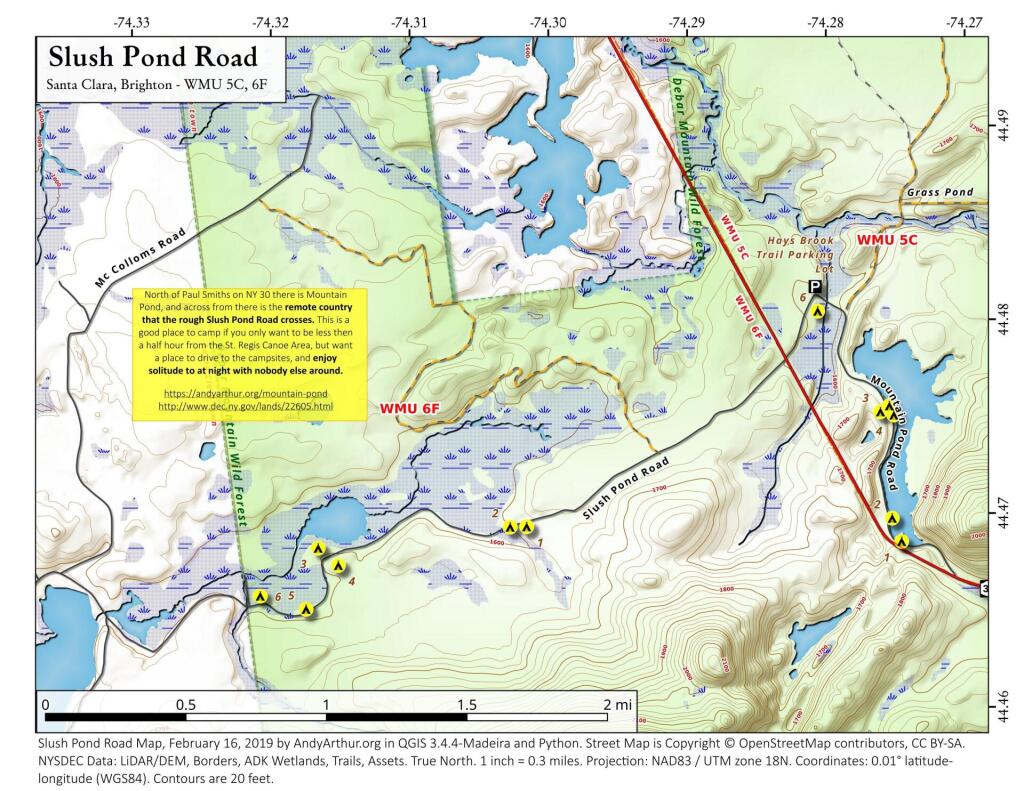
More about Mountain Pond...
Mountain Pond is a small, narrow lake, located along Old Route 30, just 2 miles north of Paul Smiths. Offers 6-roadside camping spots, along with a secluded, lesser used pond, near Barnum Pond and Osgood Pond.
Download the PDF Map Pack with All Maps from Mountain Pond.


No Comments
Slush Pond road is a very unique and stunning place. We do not need people whom have no respect to pig it up —-
Make notice—-dump their garbage either.
Please find another place .!!
As little people as possibly should know about Slush Pond
Too many individuals have no respect for wilderness.
And we do need need Slush to be on any web sites
1 Trackback or Pingback