Southern Onondoga County To The Finger Lakes 🗺️

Download a High Resolution JPEG Image of the Terrain Southern Onondoga County To The Finger Lakes or an Adobe Acrobat Printable PDF of the Terrain Southern Onondoga County To The Finger Lakes.
About Southern Onondoga County To The Finger Lakes ....
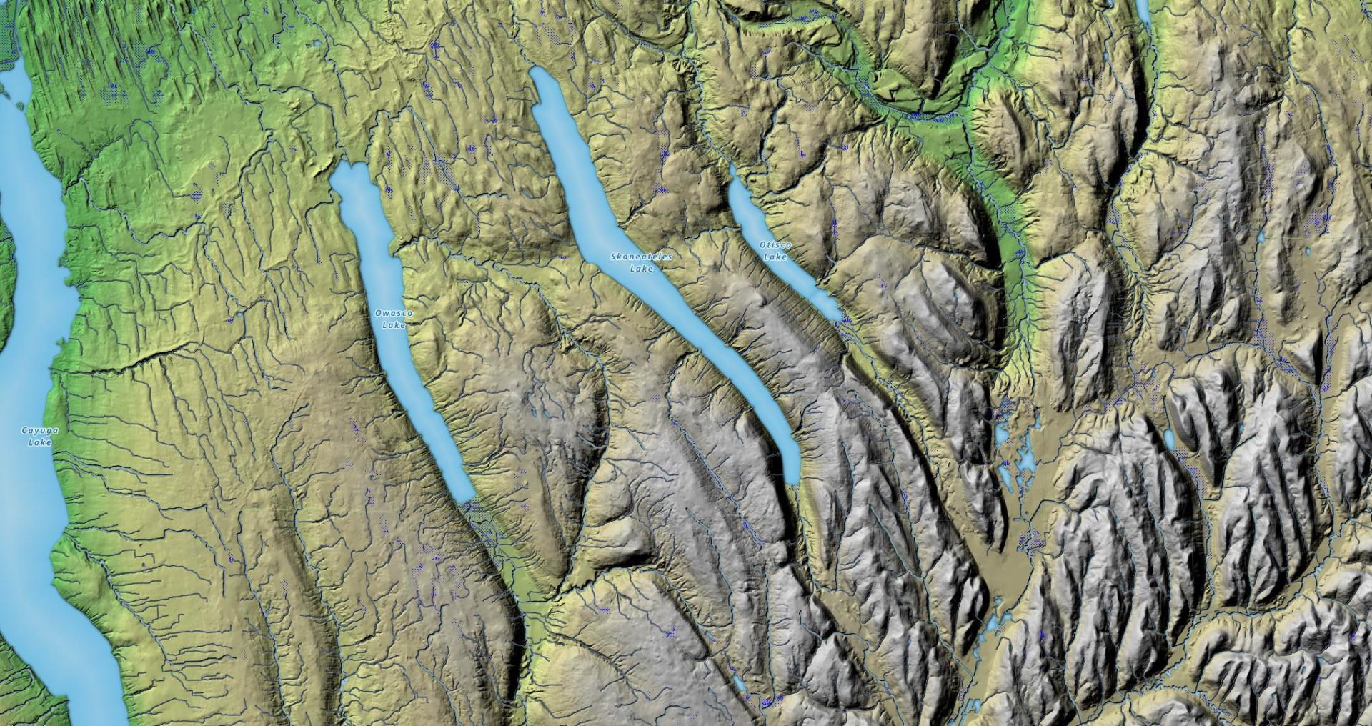
I've always been fascinated by the terrain as you drive from the hill and holler country of Southern Madison and Onondaga County, into the rolling country of the Finger Lakes, along US 20. This relief map of this region shows the change in the landscape, along with the dunes sculpted by the glaciers as you head out into the Finger Lakes.
More about Cayuga County...
Cayuga County is a county located in the U.S. state of New York. It was named for one of the tribes of Indians in the Iroquois Confederation. As of the 2010 census, the population was 80,026. Its county seat is Auburn.
Cayuga County is located in the west central part of the state, in the Finger Lakes region. Owasco Lake is in the center of the county, and Cayuga Lake forms part of the western boundary. Lake Ontario is on the northern border, and Skaneateles Lake and Cross Lake form part of the eastern border. Cayuga County has more waterfront land than any other county in the state not adjacent to the Atlantic Ocean.
http://en.wikipedia.org/wiki/Cayuga_County,_New_York


