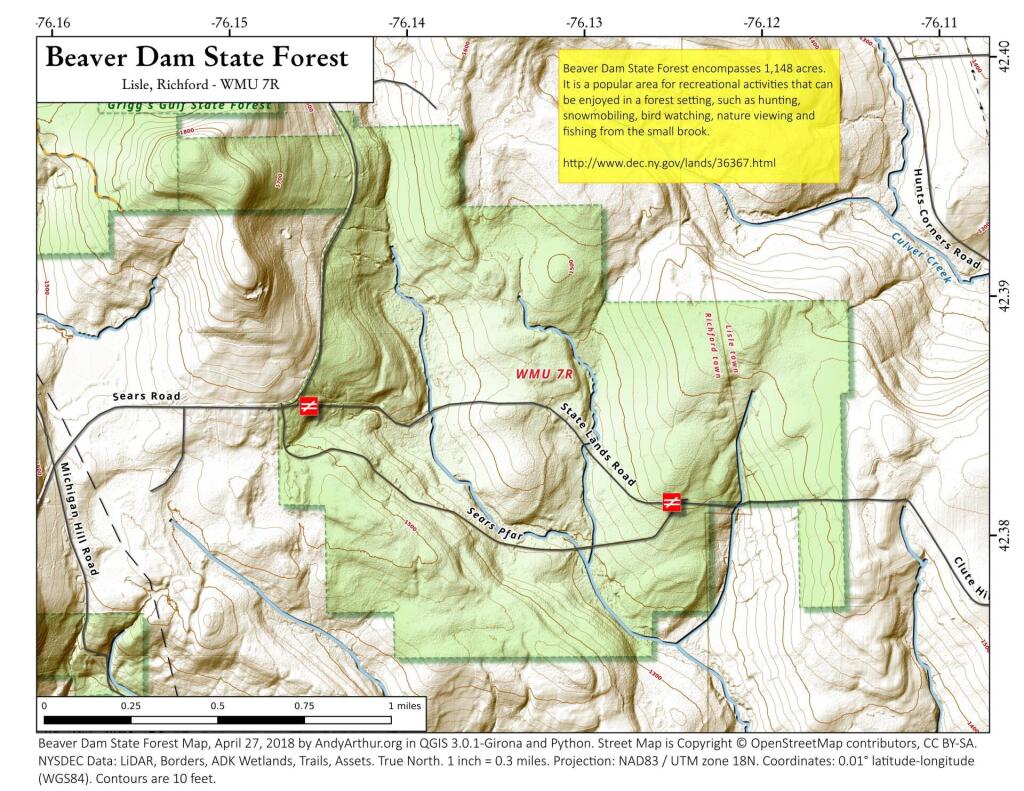
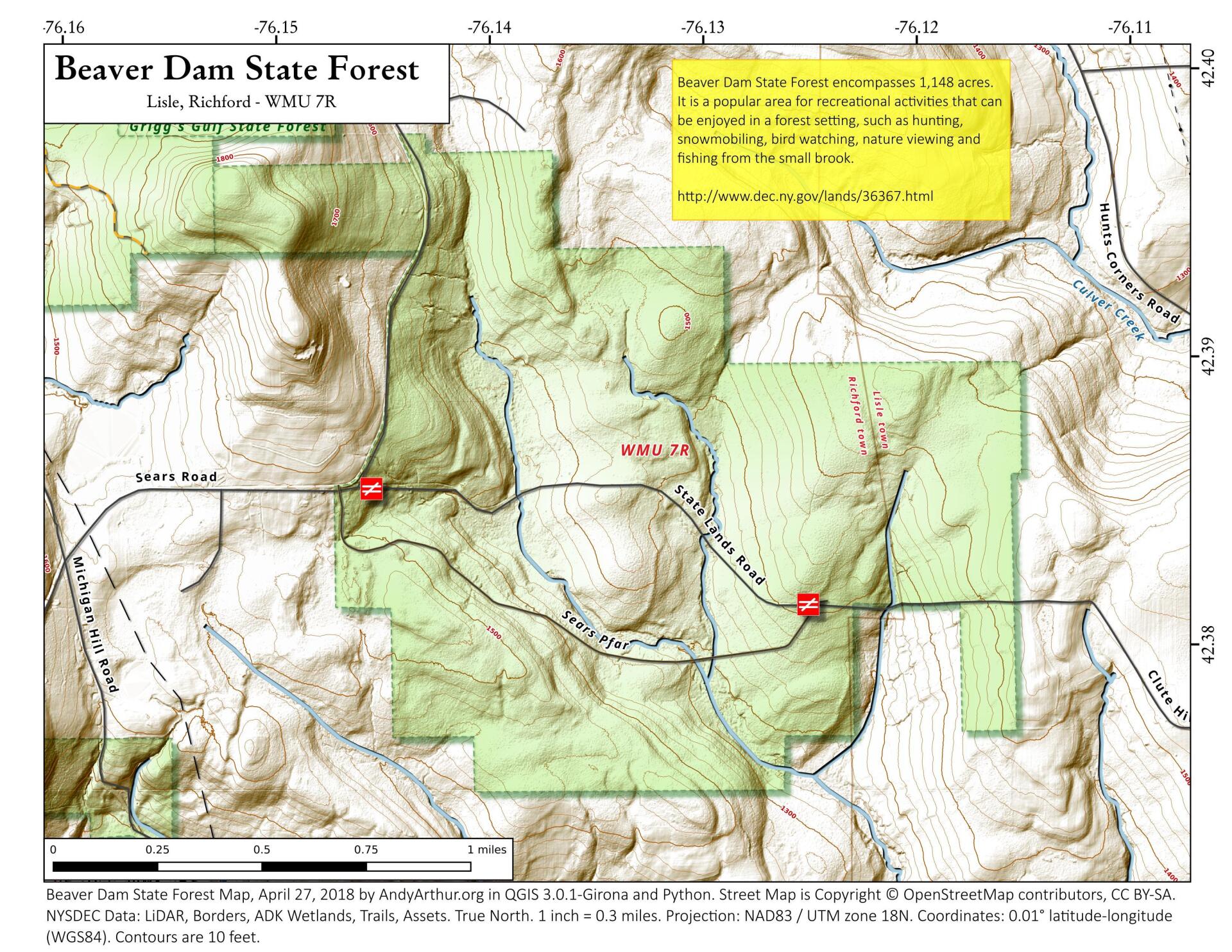
Beaver Dam State Forest
Download a High Resolution JPEG Image of the Beaver Dam State Forest or an Adobe Acrobat Printable PDF of the Beaver Dam State Forest.


Bookmark my free Interactive GPS Map for your phone:
https://andyarthur.org/ny
... shows your location as a blue dot in relationship to campsites, trails, state land. This online map requires cell service, won't work in remote country, so also bring a paper map.
Free Download of New & Historical USGS 1:24k Topograpic Maps
Interactive maps with backcountry and roadside camping: New York, Pennsylvania, West Virginia & Vermont. List of NYS DEC Lean-Tos and Firetowers.
Google Spreadsheet with Roadside, Primitive and Pay Campsites
More about Tioga County, NY...
Tioga County is a county located in the U.S. state of New York. As of the 2010 census, the population was 51,125. Its name derives from an American Indian word meaning "at the forks," describing a meeting place. Its county seat is Owego.
Tioga County is located in southwest New York State, west of Binghamton and directly north of the border with Pennsylvania. The Susquehanna River flows into Pennsylvania from this county. The county is considered part of the Southern Tier region of New York State.
The highest elevation is an unnamed 1,994-foot (607.8 m) hill in the county's northern corner.
Tioga County is part of the Binghamton Metropolitan Statistical Area.
http://en.wikipedia.org/wiki/Tioga_County,_New_York
Download the PDF Map Pack with All Maps from Tioga County, NY.

