Normanskill Ravines Park 📍

The Normans Kill Ravines Park’s address is 70 Wright Lane in Delmar, off Adams Place near the Four Corners. It is home to a rough 3.5 mile mountain bike trail that traverses up and down several ridges and swampy areas and follows roughly 250 feet of the Normans Kill. You should plan on at least 1 1/2 hours to hike this trail, as many of the inner connections (shortcut) trails are overgrown and unmarked, while the outer trail is designated “one way” and blazed only in the clockwise fashion (north -> east -> south -> west -> south).

https://www.townofbethlehem.org/893/Normans-Kill-Ravines-Park
http://walkingman247.blogspot.com/2021/06/normans-kill-ravines-parkdelmar-town-of.html
https://www.alltrails.com/trail/us/new-york/normans-kill-ravines-full-loop-trail

🗺️ Maps 🖼️ Photos

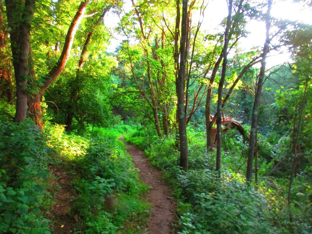
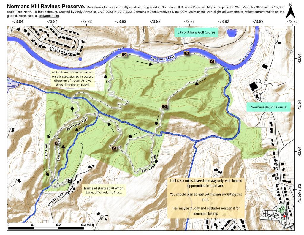
Normans Kill Ravine Park

The Normans Kill Ravines Park's address is 70 Wright Lane in Delmar, off Adams Place near the Four Corners. It is home to a rough 3.5 mile mountain bike trail that traverses up and down several ridges and swampy areas and follows roughly 250 feet of the Normans Kill. You should plan on at least 1 1/2 hours to hike this trail, as many of the inner connections (shortcut) trails are overgrown and unmarked, while the outer trail is designated "one way" and blazed only in the clockwise fashion (north -> east -> south -> west -> south).

https://www.townofbethlehem.org/893/Normans-Kill-Ravines-Park
http://walkingman247.blogspot.com/2021/06/normans-kill-ravines-parkdelmar-town-of.html
https://www.alltrails.com/trail/us/new-york/normans-kill-ravines-full-loop-trail


Map: South Bradford State Forest

Trail

Much of the trail, this time of year especially doesn't have particularly good views except when you get down to the Normans Kill, which is a bit overgrown.

Wednesday July 19, 2023 — Normanskill Ravines Park
Map: Wilcox Lake - Willis Lake Trail
Map: South Mountain State Forest
Terrain Map: Mahanoy Mountain
Terrain Map: South Western Adirondacks Peaks