Danby State Forest

Download a High Resolution JPEG Image of the Danby State Forest or an Adobe Acrobat Printable PDF of the Danby State Forest.

Bookmark my free Interactive GPS Map for your phone:
https://andyarthur.org/ny
... shows your location as a blue dot in relationship to campsites, trails, state land. This online map requires cell service, won't work in remote country, so also bring a paper map.
Free Download of New & Historical USGS 1:24k Topograpic Maps
Interactive maps with backcountry and roadside camping: New York, Pennsylvania, West Virginia & Vermont. List of NYS DEC Lean-Tos and Firetowers.
Google Spreadsheet with Roadside, Primitive and Pay Campsites
More about Danby State Forest...
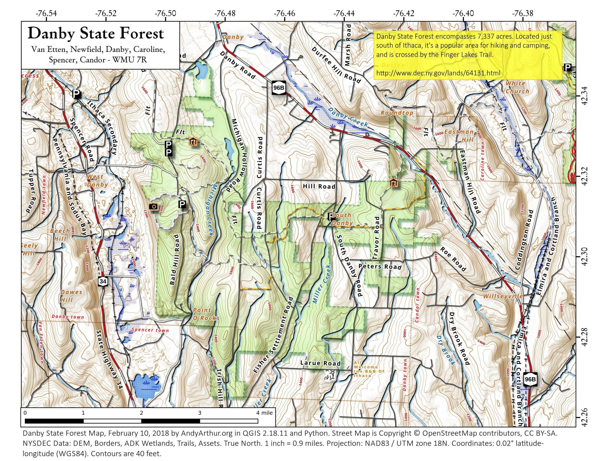
Danby State Forest (Tompkins #1) encompasses 7,337 acres of public open space in the towns of Danby, Candor and Spencer. It is one of two forests covered in the Rapid Water Unit Management Plan. Its large size and close proximity to the city of Ithaca and the Finger Lakes Region make Danby State Forest a great place to enjoy activities such as hunting, hiking, cross-country skiing, bird watching, picnicking and camping. Danby State Forest is a working State Forest that is sustainably managed to provide recreational services, diverse wildlife habitat, firewood and lumber.


