


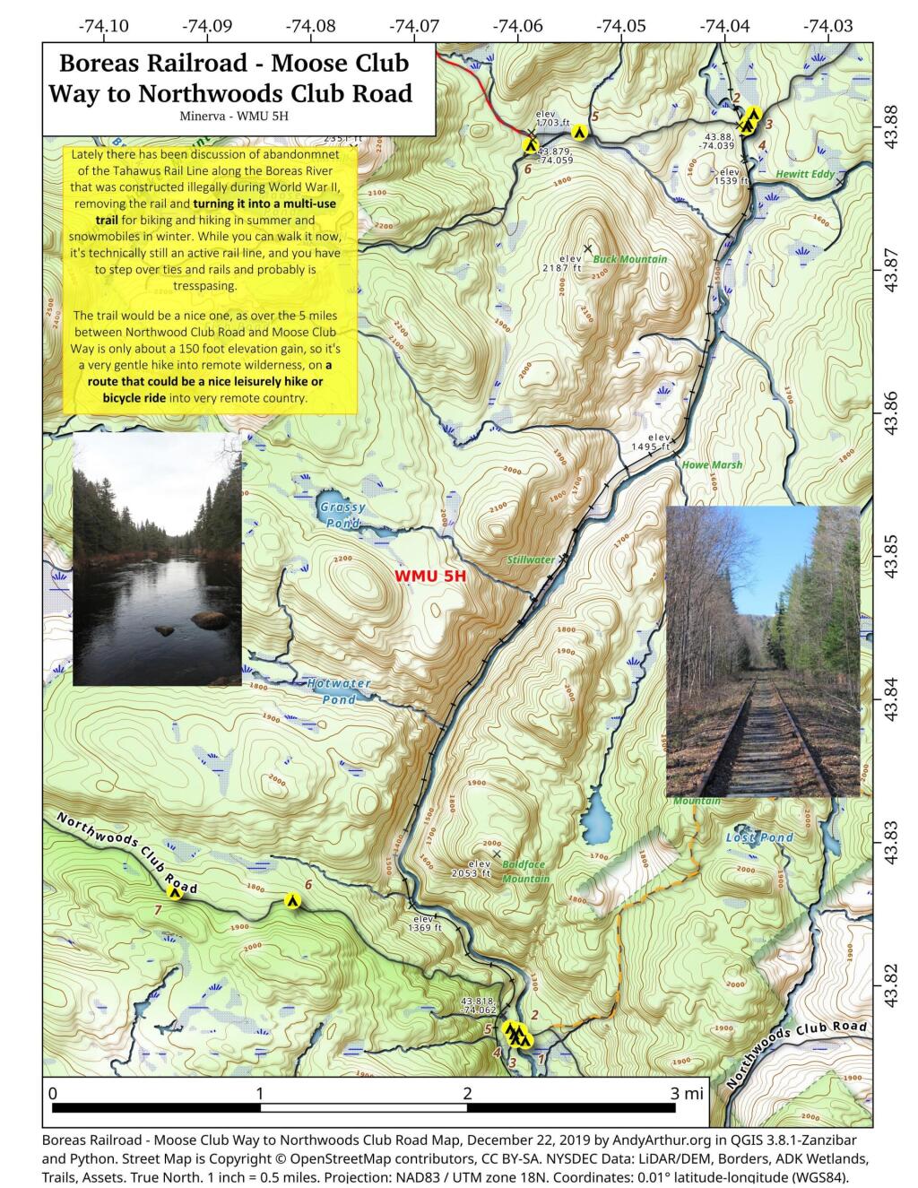
Boreas Railroad – Moose Club Way To Northwoods Club Road
Lately there has been discussion of abandonment of the Tahawus Rail Line along the Boreas River that was constructed illegally during World War II, removing the rail and turning it into a multi-use trail for biking and hiking in summer and snowmobiles in winter. While you can walk it now, it's technically still an active rail line, and you have to step over ties and rails and probably is trespassing.
The trail would be a nice one, as over the 5 miles between Northwood Club Road and Moose Club Way is only about a 150 foot elevation gain, so it's a very gentle hike into remote wilderness, on a route that could be a nice leisurely hike or bicycle ride into very remote country.

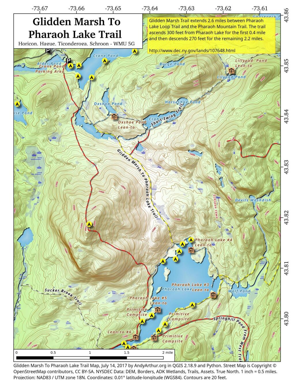
Glidden Marsh To Pharaoh Lake Trail
There are two ways to get between Crane Pond and Pharaoh Lake. One brings you over Pharoah Mountain, which has great views but it's a much bigger climb, especially on the southern side.
Pharaoh Mountain Trail (2,556 feet) extends 3.8 miles between the Pharaoh Lake Trail and Crane Pond Trail. The trails ascends 1,355 feet in 1.2 miles to the summit and then descends 1,405 feet in 2.6 miles to Crane Pond.
Glidden Marsh Trail extends 2.6 miles between Pharaoh Lake Loop Trail and the Pharaoh Mountain Trail. The trail ascends 300 feet from Pharaoh Lake for the first 0.4 mile and then descends 270 feet for the remaining 2.2 miles.