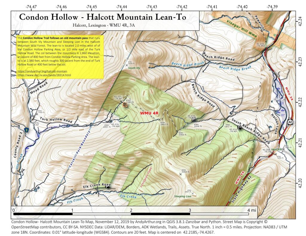
Condon Hollow Trail – Halcott Mountain Lean To
The Condon Hollow Trail follows an old mountain pass that runs between South Vly Mountain and Sleeping Lion in the Hallcott Mountain Wild Forest. The lean-to is located 2.0 miles west of of the Condon Hollow Parking Area, or 1/2 mile east of the Turk Hollow Road. The col between the mountains is 2,860 elevation, an ascent of 800 feet from Condon Hollow Parking Area. The lean-to is at 2,380 feet, which roughly 300 ascent from the end of Turk Hollow Road or 400 feet below the col. Tailhead parking at: 42.21852779311055,-74.42673587591332
More information on this forest can be found on DEC website: https://www.dec.ny.gov/lands/28314.html