Black River Wild Forest 📍

🗺️ Maps

Black River Valley

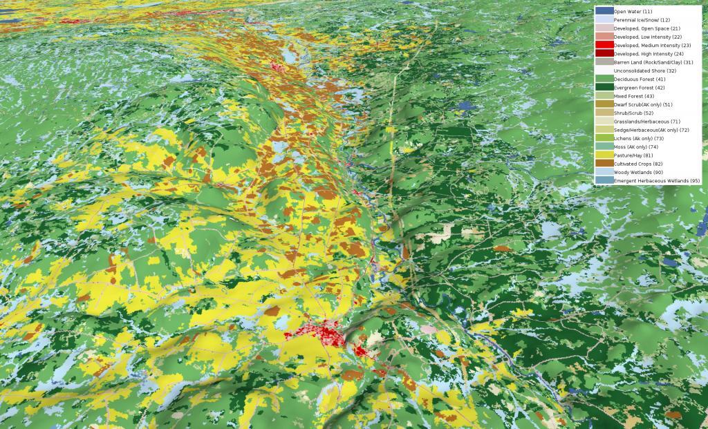
Looking at this 3D rendering of the Black River Valley, I never realized how nearly all the agriculture is on the west side of valley, climbing up into the Tug Hill Plateau. I am most of that has to do with the soils -- the east side is very sandy and infertile with a lot of timber stands. This picture starts around Boonville and heads north of Lowville, the town that rhythms with cow-ville for good reason.

Black River Valley

Map: Hays Brook Horse Trails
Map: Cat Hollow State Forest

Reeds Pond

Located at the intersection of Farr Road and North Lake Road, this lake is near the Black River, about 10 miles south of South Lake.

Map: Wolf Pond Trail

Woodhull Lake

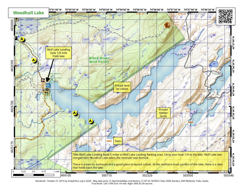
Take Wolf Lake Landing Road to the Wolf Lake Landing Parking area. Carry your boatd 1/4 mile to the lake. Wolf Lake was merged with Woodhull Lake when the reservior was formed. There is a lean-to, outhouse, and a good place to launch a hand-carried boat. AT the southern-most portion of the lake there is a a dam that holds back the lake. Part of the lake is lightly developed with cabins along the shoreline.

 Woodhull Lake

Map: Severence Hill Trail
Map: Lincoln Park