Mad River State Forest
Download a High Resolution JPEG Image of the Mad River State Forest or an Adobe Acrobat Printable PDF of the Mad River State Forest.


Bookmark my free Interactive GPS Map for your phone:
https://andyarthur.org/ny
... shows your location as a blue dot in relationship to campsites, trails, state land. This online map requires cell service, won't work in remote country, so also bring a paper map.
Free Download of New & Historical USGS 1:24k Topograpic Maps
Interactive maps with backcountry and roadside camping: New York, Pennsylvania, West Virginia & Vermont. List of NYS DEC Lean-Tos and Firetowers.
Google Spreadsheet with Roadside, Primitive and Pay Campsites
More about Mad River State Forest...
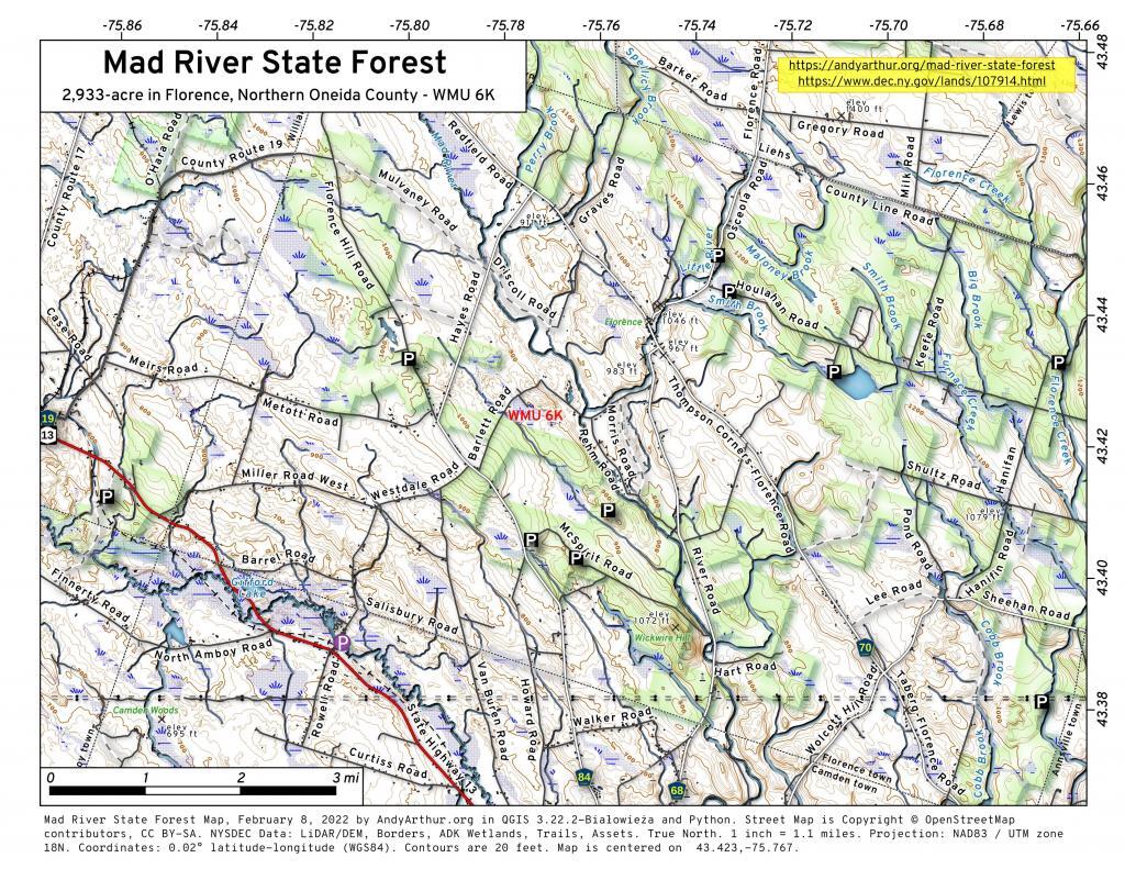
The 2,933-acre Mad River State Forest features rolling terrain with streams and wetlands interspersed throughout. It has tranquil, woodland areas that contain a mixture of plantations and natural forests. Many of the properties were purchased by the state in the 1930s and early 1940s as exhausted farmland with little or no tree cover. The first priorities after the establishment of a state forest were to reforest the land, prevent soil erosion, and minimize the threat of wildfires. This state land is currently managed for water quality protection, recreation, wildlife habitat and timber production. https://www.dec.ny.gov/lands/107914.html